
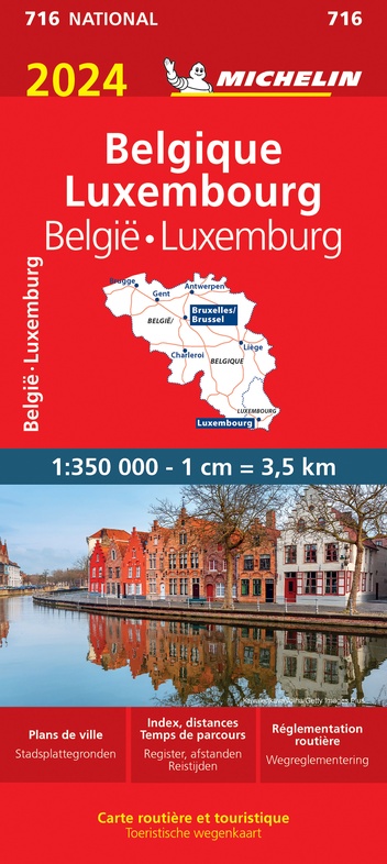
Wegenkaart - landkaart 716 Belgie en Luxemburg 2024 | Michelin (9782067262836)
- ISBN / CODE: 9782067262836
- Editie: 2024
- Schaal: 1:350000
- Uitgever: Michelin
- Soort: Wegenkaart
- Serie: National
- Taal: Nederlands, Engels, Frans
- Uitvoering: Papier
- Bindwijze: -
- Beoordeling: 5,0 ★★★★★ (2 reviews) Schrijf een review
-
€ 11,95
Op voorraad. Voor 17.00 uur op werkdagen besteld, morgen in huis in Nederland Levertijd Belgie
Gratis verzending in Nederland vanaf €35,-
Beschrijving
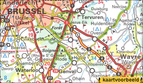
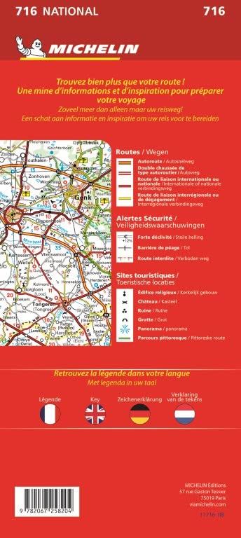
Zoals je van Michelin mag verwachten is deze kaart zeer overzichtelijk en heeft een duidelijk helder kaartbeeld. Klassiek en beroemd zijn de groene lijnen langs de aantrekkelijke wegen: zo wordt in een oogopslag duidelijk waar de mooiste plekjes te vinden zijn. De kaart geeft uitgebreid toeristische informatie weer. Met stadsplattegrond van de hoofdstad.
Belgium and Luxembourg at 1:350,000 from Michelin with information on driving regulations in each country, a distance and journey time table, plus enlargements showing in greater detail road access to Antwerp, Brussels, Liège and Luxembourg City which also has a small plan of its centre.
Reviews
Duidelijke site. Snelle levering.
★★★★★ door Frans 3 april 2024 | Heeft dit artikel gekochtVond u dit een nuttige review? (login om te beoordelen)
De kaart van België is uitstekend
★★★★★ door Remco Klein 6 november 2018Vond u dit een nuttige review? (login om te beoordelen)
Schrijf een review
Graag horen wij wat u van dit artikel vindt. Vindt u het goed, leuk, mooi, slecht, lelijk, onbruikbaar of erg handig: schrijf gerust alles op! Het is niet alleen leuk om te doen maar u informeert andere klanten er ook nog mee!
Ook interessant voor europa/belgie
-

Reisgids Belgium & Luxembourg - Belg
€ 20,95Reisgidsen België -

Wegenkaart - landkaart 795 Benelux 2
€ 12,95Wegenkaarten België -

Wandelkaart 13 Haute Sure - Martelan
€ 13,50Wandelkaarten Wallonië -

Campergids Facile-en-Route campergid
€ 17,95Campergidsen België -

Wegenatlas Benelux | ANWB Media
€ 15,99Wegenatlassen België