Historische Kaarten - Engeland
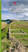
 Historische Kaart An Archaeological Map of Hadrian's Wall | English Heritage
It was more than just a wall: it was a whole military zone designed to control movement across the northern frontier of the Roman province of Britannia. Great earthwork barriers …
 Historische Kaart Exploring the World Heritage Site – Stonehenge and Avebury | English Heritage
The Stonehenge and Avebury World Heritage Site is internationally important for its outstanding prehistoric monuments. Stonehenge is the most architecturally sophisticated prehistoric stone circle in the world, while Avebury is …
 Historische Kaart Hadrian's Wall | Northern Heritage Services
A beautifully illustrated fold-out map of Hadrian's Wall on one side and short history and guide on the other. The historical sites have been chosen because of their archaeological interest …
Laatste reviews

Perfecte kwaliteit, had die heel graag in het nederlands kunnen bestellen
★★★★★ door Caty Eeckhout 20 januari 2025 | Heeft dit artikel gekocht
Helaas een aantal wandelroutes niet meer beloopbaar, de routes zijn niet meer te vinden. Ook zijn er routes aangepast,afstanden kloppen niet meer. Beter online opzoeken …
★★★★★ door Rieneke 20 januari 2025 | Heeft dit artikel gekocht
Geeft onze kinderen een realistische blik op de wereld. Met reliëf. En als lamp aan zie je de landsgrenzen. Mooie kwaliteit. Verrassend snelle verzending rondom …
★★★★★ door Jojanneke 20 januari 2025 | Heeft dit artikel gekocht
Zoals altijd biedt ook deze Lonely Planet veel nuttige en gedetailleerde informatie over activiteiten buiten de toeristische standaardbestemmingen. Ook de praktische tips (vervoer, geld) bleken …
★★★★★ door Wessel 19 januari 2025 | Heeft dit artikel gekocht


