Stadsplattegrond - Wandelkaart London walk - Urban maps | Ordnance Survey (9780319091944)
- ISBN / CODE: 9780319091944
- Editie: 06-11-2020
- Aantal blz.: 1
- Uitgever: Ordnance Survey
- Soort: Stadsplattegrond, Wandelkaart
- Serie: OS
- Taal: Engels
- Hoogte: 18.0 cm
- Breedte: 14.0 cm
- Gewicht: 84.0 g
- Uitvoering: Papier
- Bindwijze: -
- Schrijf als eerste een review
-
€ 15,95
Leverbaar in 3 - 5 werkdagen in huis in Nederland Levertijd Belgie
Gratis verzending in Nederland vanaf €35,-
Beschrijving
Van de uitgever
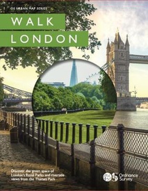
This brand new OS Urban Map will help you discover London's secrets, including the Royal Parks and the Thames Path.
Pocket sized, and coming with it's own protective slip case, this double-sided map has everything you need to discover the hidden (and not so hidden) green spaces in Great Britain's capital. On one side are the Royal Parks: Richmond Park, Kensington Gardens, Hyde Park and Greenwich Park, each with a suggested walking route and packed with key things to see and do.
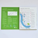
The reverse has the Thames Path from Richmond Bridge to Greenwich, handily snipped into short manageable sections so you can choose a quick walk or take on the full route. Each map section has information on access, key features and places of interest along the way.
The OS Urban Walk London map is folded in a 'concertina' pattern, so you can see the entire Thames Path at once, or just focus on a small area, and uses a combination of simplified street mapping and a new 3d view to make it easy for anyone to use. Ideal for both visitors and locals alike.
Reviews
Geen reviews gevonden voor dit product.
Schrijf een review
Graag horen wij wat u van dit artikel vindt. Vindt u het goed, leuk, mooi, slecht, lelijk, onbruikbaar of erg handig: schrijf gerust alles op! Het is niet alleen leuk om te doen maar u informeert andere klanten er ook nog mee!


