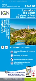
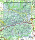
Wandelkaart - Topografische kaart 2543OT Lamalou-les-Bains, Olargues, Roquebrun, Le Caroux, PNR du Haut Languedoc | IGN - Institut Géographique National (9782758546528)
- ISBN / CODE: 9782758546528
- Editie: 23-04-2019
- Druk: 3
- Aantal blz.: 1
- Schaal: 1:25000
- Uitgever: IGN - Institut Géographique National
- Soort: Topografische kaart, Wandelkaart
- Serie: Top 25
- Taal: Frans
- Hoogte: 24.0 cm
- Breedte: 11.0 cm
- Gewicht: 93.0 g
- Bindwijze: -
- Uitvoering: Papier
- Beoordeling: 5,0 ★★★★★ (1 review) Schrijf een review
-
€ 16,95
Op voorraad. Voor 17.00 uur op werkdagen besteld, binnen 1 tot 2 werkdagen in huis in Nederland Levertijd Belgie
Gratis verzending in Nederland vanaf €35,-
-
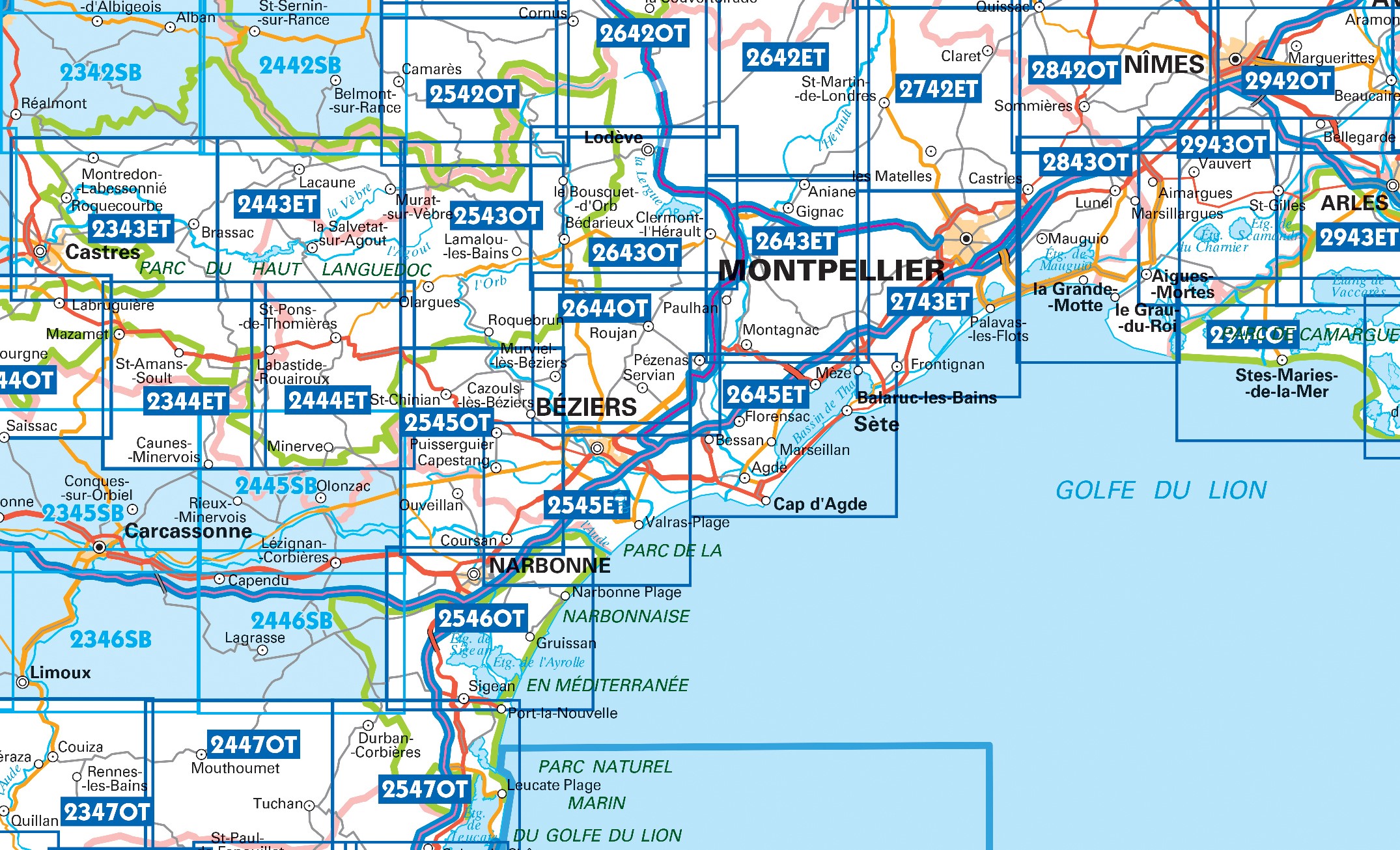
Topografische kaarten IGN 25.000 Languedoc -Rousillon


Producten op deze overzichtskaart:
Klik op een product om naar de pagina van dat product te gaan.
- Wandelkaart - Topografische kaart 2243 SB - Serie Bleue Puylaurens, Lautrec | IGN - Institut Géographique National
- Wandelkaart - Topografische kaart 2342 SB - Serie Bleue Réalmont - Alban | IGN - Institut Géographique National
- Wandelkaart - Topografische kaart 2343ET Castres, Sidobre, Brassac, Vebre, PNR du Haut Languedoc | IGN - Institut Géographique National
- Wandelkaart - Topografische kaart 2344ET Montagne Noire est | IGN - Institut Géographique National
- Wandelkaart - Topografische kaart 2344OT Montagne Noire (ouest) - Revel - Labrugiere - PNR du Haut Languedoc | IGN - Institut Géographique National
- Wandelkaart - Topografische kaart 2345 SB - Serie Bleue Carcassonne - Alzonne | IGN - Institut Géographique National
- Wandelkaart - Topografische kaart 2346 SB - Serie Bleue Cazilhac - Limoux | IGN - Institut Géographique National
- Wandelkaart - Topografische kaart 2442 SB - Serie Bleue Belmont-sur-Rance, St-Sernin-sur-Rance | IGN - Institut Géographique National
- Wandelkaart - Topografische kaart 2443ET Monts de Lacaune, La Salvetat - sur - Agout, PNR du Haut Languedoc | IGN - Institut Géographique National
- Wandelkaart - Topografische kaart 2444ET Somail - Minervois | IGN - Institut Géographique National
- Wandelkaart - Topografische kaart 2445 SB - Serie Bleue Lézignan - Corbieres, Rieux-Minervois | IGN - Institut Géographique National
- Wandelkaart - Topografische kaart 2446 SB - Serie Bleue Ferrals-les-Corbières, Capendu | IGN - Institut Géographique National
- Wandelkaart - Topografische kaart 2542OT Camarès - Avène | IGN - Institut Géographique National
- Wandelkaart - Topografische kaart 2543OT Lamalou-les-Bains, Olargues, Roquebrun, Le Caroux, PNR du Haut Languedoc | IGN - Institut Géographique National
- Wandelkaart - Topografische kaart 2545OT St-Chinian - L'etang de Montady | IGN - Institut Géographique National
- Wandelkaart - Topografische kaart 2546OT Narbonne | IGN - Institut Géographique National
- Wandelkaart - Topografische kaart 2547OT Durban, Corbieres, Leucate, Plages du Roussillon | IGN - Institut Géographique National
- Wandelkaart - Topografische kaart 2642ET St.-Guilhem-le-Desert | IGN - Institut Géographique National
- Wandelkaart - Topografische kaart 2642OT Le Caylar - La Couvertoirade | IGN - Institut Géographique National
- Wandelkaart - Topografische kaart 2643ET Clermont-l'Hérault | IGN - Institut Géographique National
- Wandelkaart - Topografische kaart 2644OT Pézenas - Murviel-lès-Béziers | IGN - Institut Géographique National
- Wandelkaart - Topografische kaart 2645ET Cap d'Agde - Sète - Etang de Thau | IGN - Institut Géographique National
- Wandelkaart - Topografische kaart 2742ET St.-Martin-de-Londres, Ganges | IGN - Institut Géographique National
- Wandelkaart - Topografische kaart 2743ET Montpellier | IGN - Institut Géographique National
- Wandelkaart - Topografische kaart 2842OT Sommières, Vergèze | IGN - Institut Géographique National
- Wandelkaart - Topografische kaart 2843OT Aigues - Mortes - La Grande Motte | IGN - Institut Géographique National
- Wandelkaart - Topografische kaart 2943OT Saint-Gilles - Vauvert | IGN - Institut Géographique National
- Wandelkaart - Topografische kaart 2944OT Saintes-Maries-de-la-Mer | IGN - Institut Géographique National
-
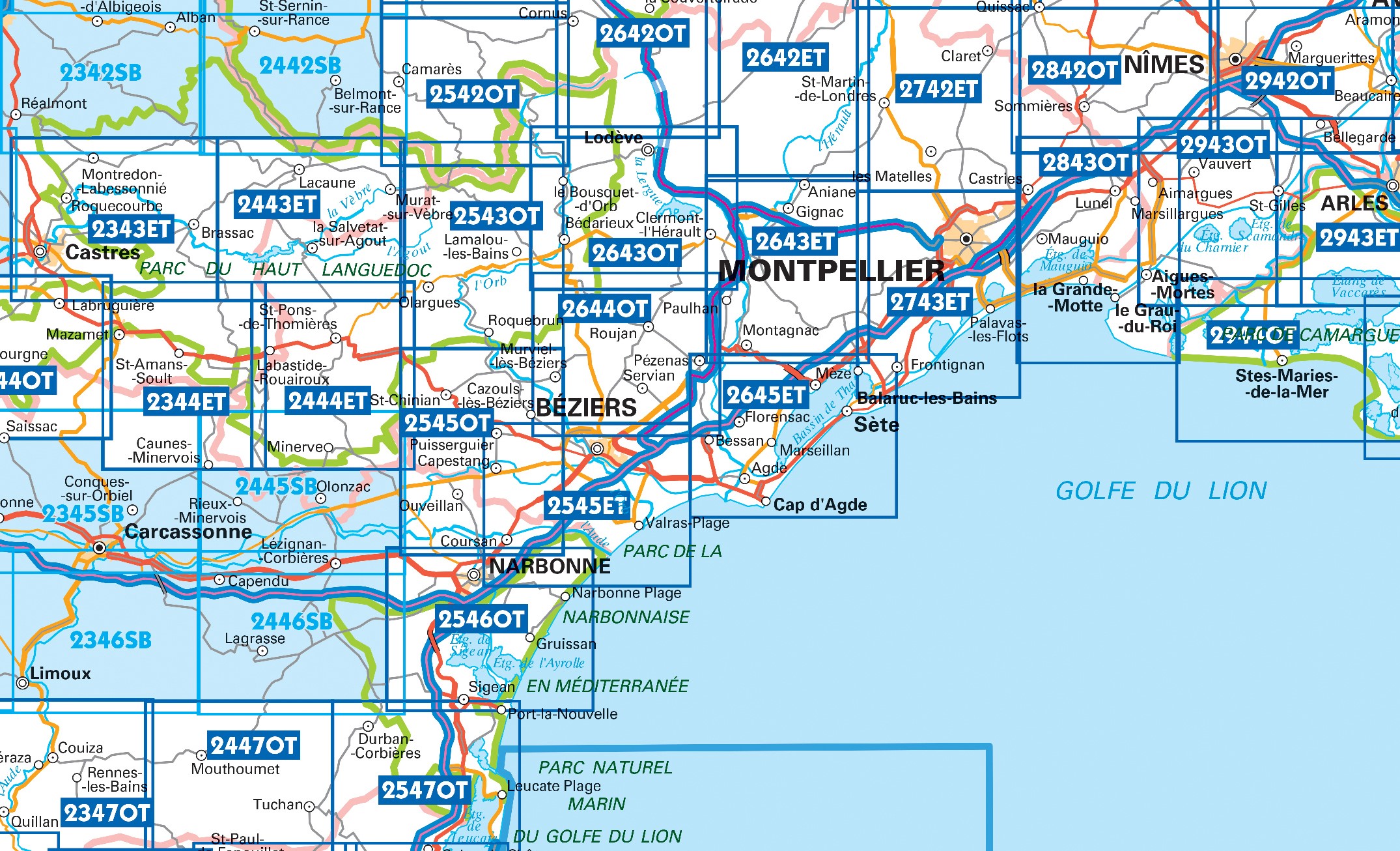
Wandelkaarten IGN 25.000 Languedoc -Rousillon


Producten op deze overzichtskaart:
Klik op een product om naar de pagina van dat product te gaan.
- Wandelkaart - Topografische kaart 2243 SB - Serie Bleue Puylaurens, Lautrec | IGN - Institut Géographique National
- Wandelkaart - Topografische kaart 2342 SB - Serie Bleue Réalmont - Alban | IGN - Institut Géographique National
- Wandelkaart - Topografische kaart 2343ET Castres, Sidobre, Brassac, Vebre, PNR du Haut Languedoc | IGN - Institut Géographique National
- Wandelkaart - Topografische kaart 2344ET Montagne Noire est | IGN - Institut Géographique National
- Wandelkaart - Topografische kaart 2344OT Montagne Noire (ouest) - Revel - Labrugiere - PNR du Haut Languedoc | IGN - Institut Géographique National
- Wandelkaart - Topografische kaart 2345 SB - Serie Bleue Carcassonne - Alzonne | IGN - Institut Géographique National
- Wandelkaart - Topografische kaart 2346 SB - Serie Bleue Cazilhac - Limoux | IGN - Institut Géographique National
- Wandelkaart - Topografische kaart 2442 SB - Serie Bleue Belmont-sur-Rance, St-Sernin-sur-Rance | IGN - Institut Géographique National
- Wandelkaart - Topografische kaart 2443ET Monts de Lacaune, La Salvetat - sur - Agout, PNR du Haut Languedoc | IGN - Institut Géographique National
- Wandelkaart - Topografische kaart 2444ET Somail - Minervois | IGN - Institut Géographique National
- Wandelkaart - Topografische kaart 2445 SB - Serie Bleue Lézignan - Corbieres, Rieux-Minervois | IGN - Institut Géographique National
- Wandelkaart - Topografische kaart 2446 SB - Serie Bleue Ferrals-les-Corbières, Capendu | IGN - Institut Géographique National
- Wandelkaart - Topografische kaart 2542OT Camarès - Avène | IGN - Institut Géographique National
- Wandelkaart - Topografische kaart 2543OT Lamalou-les-Bains, Olargues, Roquebrun, Le Caroux, PNR du Haut Languedoc | IGN - Institut Géographique National
- Wandelkaart - Topografische kaart 2545OT St-Chinian - L'etang de Montady | IGN - Institut Géographique National
- Wandelkaart - Topografische kaart 2546OT Narbonne | IGN - Institut Géographique National
- Wandelkaart - Topografische kaart 2547OT Durban, Corbieres, Leucate, Plages du Roussillon | IGN - Institut Géographique National
- Wandelkaart - Topografische kaart 2642ET St.-Guilhem-le-Desert | IGN - Institut Géographique National
- Wandelkaart - Topografische kaart 2642OT Le Caylar - La Couvertoirade | IGN - Institut Géographique National
- Wandelkaart - Topografische kaart 2643ET Clermont-l'Hérault | IGN - Institut Géographique National
- Wandelkaart - Topografische kaart 2643OT Lodeve | IGN - Institut Géographique National
- Wandelkaart - Topografische kaart 2644OT Pézenas - Murviel-lès-Béziers | IGN - Institut Géographique National
- Wandelkaart - Topografische kaart 2645ET Cap d'Agde - Sète - Etang de Thau | IGN - Institut Géographique National
- Wandelkaart - Topografische kaart 2742ET St.-Martin-de-Londres, Ganges | IGN - Institut Géographique National
- Wandelkaart - Topografische kaart 2743ET Montpellier | IGN - Institut Géographique National
- Wandelkaart - Topografische kaart 2842OT Sommières, Vergèze | IGN - Institut Géographique National
- Wandelkaart - Topografische kaart 2843OT Aigues - Mortes - La Grande Motte | IGN - Institut Géographique National
- Wandelkaart - Topografische kaart 2943OT Saint-Gilles - Vauvert | IGN - Institut Géographique National
- Wandelkaart - Topografische kaart 2944OT Saintes-Maries-de-la-Mer | IGN - Institut Géographique National
Overzichtskaarten
Beschrijving
Reviews
Fantastisch efficiënte manier om snel de Franse topografische kaarten in België geleverd te krijgen. Nog nooit een Out of stock voorgeschoteld gekregen. Ik ben fan.
★★★★★ door Brigitte De Kock 11 juli 2022 | Heeft dit artikel gekochtVond u dit een nuttige review? (login om te beoordelen)
Schrijf een review
Graag horen wij wat u van dit artikel vindt. Vindt u het goed, leuk, mooi, slecht, lelijk, onbruikbaar of erg handig: schrijf gerust alles op! Het is niet alleen leuk om te doen maar u informeert andere klanten er ook nog mee!


