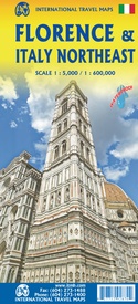
Stadsplattegrond Florence & Italië Noord-Oost | ITMB (9781771292870)
- ISBN / CODE: 9781771292870
- Editie: 19-10-2022
- Druk: 1
- Aantal blz.: 1
- Schaal: 1:5000
- Uitgever: ITMB
- Soort: Stadsplattegrond
- Taal: Engels
- Hoogte: 25.0 cm
- Breedte: 10.0 cm
- Gewicht: 121.0 g
- Bindwijze: -
- Uitvoering: Scheur- en watervast
- Schrijf als eerste een review
-
€ 12,95
Leverbaar in 3 - 5 werkdagen in huis in Nederland Levertijd Belgie
Gratis verzending in Nederland vanaf €35,-
Beschrijving
Van de uitgever
Stadsplan Firenze - Wegenkaart Italië Noordoost
Florence, or Firenze in Italian, is one of the most fascinating cities on earth. It is a treasure trove of museums, statues, plazas, narrow streets, and expensive stores. Lan and I spent a week here last December, representing Canada at an international convention. We had our artwork ready to go to press, but we wanted one last opportunity to check our data. It proved to be a wise decision. We found many changes that were unrecorded-hotels out of existence, restaurants either closed down or open with new names, many churches closed, and others converted to other uses, two tram lines not shown on other maps, and lots of disruption caused by the advent of Omicron, which seems like it has been here forever instead of just a few months. The Florence side covers from the fortress north of the main railway station to south of the Bobolini Park and from the Hippodrome east to the Asics Firenze Sports complex, and all at an easy-to-use 1:5,000 scale on waterproof paper. The rapid transit lines, which extend to the airport and the regional bus lines off the map, are clearly shown. Dozens upon dozens of hotels, restaurants, churches, plazas, statures, and important buildings are noted, as well as quite a few grocery stores, bars, electric bike recharging stations, bus stops, museums, theatres, bike routes, and libraries. This map was exhaustive to research! The reverse side is a map of much of central Italy. We call it the Northeast because it starts in Trieste and follows the northern border to Milan, then goes down to Genoa and on to Pisa, Siena, Perugia, and Viterbo. Motorways are shown in purple, with main roads in red. Top attractions are noted. Thus, one can enjoy Florence and take day trips using the same convenient map!
Legend Includes:
Roads by classification, Rivers and Lakes, National Park, Airports, Points of Interests, Highways, Main Roads, Zoos, Fishing, and much more.
Reviews
Geen reviews gevonden voor dit product.
Schrijf een review
Graag horen wij wat u van dit artikel vindt. Vindt u het goed, leuk, mooi, slecht, lelijk, onbruikbaar of erg handig: schrijf gerust alles op! Het is niet alleen leuk om te doen maar u informeert andere klanten er ook nog mee!


