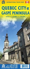
Stadsplattegrond - Wegenkaart - landkaart Quebec City & Gaspe Peninsula | ITMB (9781771296427)
- ISBN / CODE: 9781771296427
- Editie: 07-02-2020
- Druk: 1
- Aantal blz.: 1
- Schaal: 1:10000
- Uitgever: ITMB
- Soort: Stadsplattegrond, Wegenkaart
- Taal: Engels
- Hoogte: 25.0 cm
- Breedte: 10.0 cm
- Gewicht: 51.0 g
- Uitvoering: Papier
- Bindwijze: -
- Schrijf als eerste een review
-
€ 13,95
Leverbaar in 3 - 5 werkdagen in huis in Nederland Levertijd Belgie
Gratis verzending in Nederland vanaf €35,-
Beschrijving
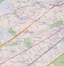
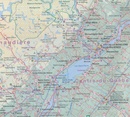
Een degelijke kaart aan twee kanten bedrukt. Aan de ene zijde een plattegrond van Quebec stad, schaal 1:10.000. En aan de andere zijde een wegenkaart, schaal 1:750.000, van Gaspe schiereiland met aanduidingen van o.a. nationale parken, vliegveld, benzinepomp, dirt-roads.
ITMB is pleased to be introducing yet another brand new title to our line. Quebec City is one of the oldest urban areas in North America, having been continuously occupied since 1608 (unfortunately, the first attempt at settlement, in 1606, failed through poor planning, and all the settlers perished). QC is also the only completely walled city in North America and the city streets within the walls have barely changed in 400 years. The city is also linguistically unique in being almost completely French Canadian in language (Montreal is much more Anglophiled). The city was the capital of French Canada until General Wolfe and the British army arrived in 1759. The British were able to climb the cliffs protecting the city from the St. Lawrence River during the night, and presented a mustered force that French General Montcalm had to confront at daybreak. Following a set-piece 18th century battle, in which both Wolfe and Montcalm were mortally wounded, the British won the day and ended French dominance in the Western Hemisphere (although it would not formally end until the sale of Louisiana in 1803). The city is rich in history, a frequent visitor of cruise ships, and easily accessible from the USA and all parts of Canada. This is the most unusual city in North America, so well worth a visit! The second side of the sheet covers the Eastern Townships south of Montreal all the way along the course of the massive St. Lawrence to the vast peninsula guarding access to the great waterway, called the Gaspe Peninsula. This is one of the great touristic driving realities of Canada, from Riviere-du-Loup to Matane to Perce Rock at the tip of this great peninsula. Inset maps of downtown Montreal and of the Montreal region are included, but the focal point for this map is the unique mass of this historically-significant peninsula of granite that had guarded Canada for centuries.
Reviews
Geen reviews gevonden voor dit product.
Schrijf een review
Graag horen wij wat u van dit artikel vindt. Vindt u het goed, leuk, mooi, slecht, lelijk, onbruikbaar of erg handig: schrijf gerust alles op! Het is niet alleen leuk om te doen maar u informeert andere klanten er ook nog mee!


