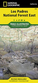
Wandelkaart 812 Los Padres National Forest East | National Geographic (9781566955805)
- ISBN / CODE: 9781566955805
- Editie: 01-01-2012
- Aantal blz.: 1
- Schaal: 1:80000
- Uitgever: National Geographic
- Soort: Wandelkaart
- Serie: Trails Illustrated Topographic Maps
- Taal: Engels
- Hoogte: 19.0 cm
- Breedte: 10.0 cm
- Gewicht: 97.0 g
- Bindwijze: -
- Uitvoering: Scheur- en watervast
- Schrijf als eerste een review
-
€ 17,95
Dit artikel is (tijdelijk) niet leverbaar
-
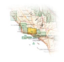
Overzicht Wandelkaarten California Trails Illustrated National Geographic
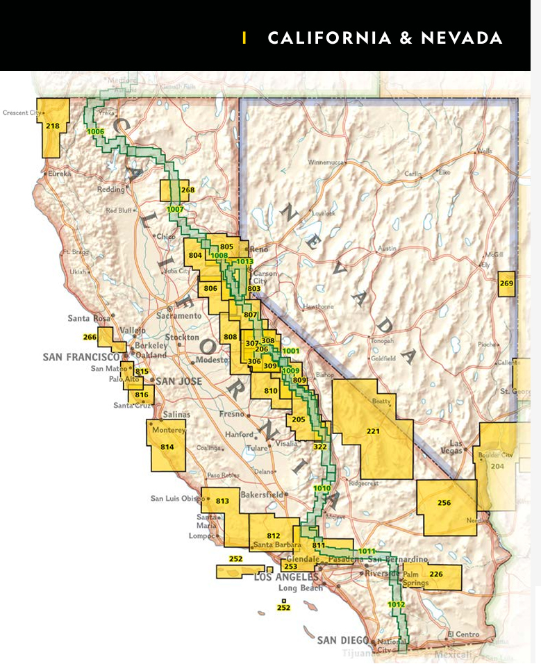
Producten op deze overzichtskaart:
Klik op een product om naar de pagina van dat product te gaan.
- Wandelatlas - Wandelkaart 1001 John Muir Trail | National Geographic
- Wandelkaart 1008 Pacific Crest Trail: Sierra Nevada North | National Geographic
- Wandelkaart - Topografische kaart 205 Sequoia - Kings Canyon National Parks | National Geographic
- Wandelkaart - Topografische kaart 206 Yosemite National Park | National Geographic
- Wandelkaart 218 Redwood National & State Parks | National Geographic
- Wandelkaart - Topografische kaart 221 Trails Illustrated Death Valley National Park | National Geographic
- Wandelkaart - Topografische kaart 226 Joshua Tree National Park | National Geographic
- Wandelkaart - Topografische kaart 256 Mojave National Preserve | National Geographic
- Wandelkaart 268 Lassen Volcanic National Park | National Geographic
- Wandelkaart - Topografische kaart 306 Yosemite SW - Yosemite Valley & Wawona | National Geographic
- Wandelkaart - Topografische kaart 307 Yosemite NW - Hetch Hetchy Reservoir | National Geographic
- Wandelkaart - Topografische kaart 308 Yosemite NE - Tuolumne Meadows and Hoover Wilderness | National Geographic
- Wandelkaart 309 Yosemite SE - Ansel Adams Wilderness | National Geographic
- Wandelkaart - Topografische kaart 803 Lake Tahoe Basin | National Geographic
- Wandelkaart 804 Tahoe National Forest West - Yuba & American Rivers | National Geographic
- Wandelkaart 805 Tahoe National Forest East - Sierra Buttes, Donner Pass | National Geographic
- Wandelkaart - Topografische kaart 809 Mammoth Lakes - Mono Divide - Inyo and Sierra National Forests | National Geographic
- Wandelkaart - Topografische kaart 810 Shaver Lake - Sierra National Forest | National Geographic
- Wandelkaart 811 Angeles National Forest | National Geographic
- Wandelkaart 812 Los Padres National Forest East | National Geographic
- Wandelkaart 814 Big Sur / Ventana Wilderness /CA | National Geographic
Overzichtskaarten
Beschrijving
Van de uitgever
One of the most diverse National Forests in the United States, Los Padres National Forest provides recreation opportunities for a enormous population base in central and southern California. National Geographic's Trails Illustrated map of Los Padres National Forest East will serve outdoor enthusiasts looking to enjoy the wide range of activities that the National Forest has to offer. Expertly researched and created in partnership with the U.S. Forest Service, California State Parks and others, the maps covers with unparalleled detail the area from Santa Barbara in the west to the National Forest's eastern boundary with Angeles National Forest. Coverage includes many popular points of interest, including Chumash, Dick Smith, Matilija and Sespe Wilderness Area; Sisquoc, Sespe Creek and Piru Creek Scenic Rivers; Fort Tejon and El Presidio de Santa Barbara State Historic Parks; Hungry Valley Recreation Area; and Carpinteria State Beach.
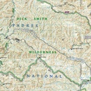
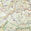
Navigate the area by following mapped trails, including many National Recreation Trails, shown with mileage markers and labeled according to designated usage, whether exploring on foot, horseback, mountain bike, motorcycle or ATV. To aid in your navigation, the map displays contour lines, elevations, labeled peaks and summits, water features, numbered Forest Service roads and OHV routes, and color-coded boundaries between different land management agencies. Among the many recreation spots pinpointed include areas for camping, picnics, boat launching, fishing, swimming, surfing, widlife viewing and winter recreation. The Jacinto Reyes and San Marcos Pass Road Scenic Byways are marked for those wishing to explore the by car.
Every Trails Illustrated map is printed on "Backcountry Tough" waterproof, tear-resistant paper. A full UTM grid is printed on the map to aid with GPS navigation.
Other features found on this map include: Angeles National Forest, Carpinteria, Chumash Wilderness, Dick Smith Wilderness, Fillmore, Lake Casitas, Lake Piru, Los Padres National Forest, Matilija Wilderness, Piru Creek, Pyramid Lake, San Emigdio Mountains, San Rafael Wilderness, Santa Barbara, Santa Ynez Mountains, Sespe Creek, Sespe Wilderness, Tejon Pass.
Reviews
Geen reviews gevonden voor dit product.
Schrijf een review
Graag horen wij wat u van dit artikel vindt. Vindt u het goed, leuk, mooi, slecht, lelijk, onbruikbaar of erg handig: schrijf gerust alles op! Het is niet alleen leuk om te doen maar u informeert andere klanten er ook nog mee!


