Mandje Tel: +31503126950 Menu
Winkelwagen
Geen items in winkelwagen
Ga naar winkelwagen

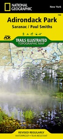
Wandelkaart - Topografische kaart 746 Adirondack Park - Saranac - Paul Smiths | National Geographic (9781566953726)

  • ISBN / CODE: 9781566953726
  • Editie: 01-04-2019
  • Aantal blz.: 1
  • Schaal: 1:75000
  • Uitgever: National Geographic
  • Soort: Topografische kaart, Wandelkaart
  • Taal: Engels
  • Hoogte: 19.0 cm
  • Breedte: 10.0 cm
  • Gewicht: 92.0 g
  • Uitvoering: Scheur- en watervast
  • Schrijf als eerste een review
  • 17,95

    Dit artikel is (tijdelijk) niet leverbaar Dit artikel is (tijdelijk) niet leverbaar

Beschrijving

Prachtige geplastificeerde kaart van het bekende nationaal park. Met alle recreatieve voorzieningen als campsites, maar ook met topografische details en wandelroutes ed. Door uitgekiend kleurgebruik zeer prettig in gebruik. Scheur en watervast!
 
National Geographic's Trails Illustrated map of Adirondack Park Saranac/Paul Smiths is a two-sided, waterproof, topographic trail map designed to meet the needs of outdoor enthusiasts with unmatched durability and detail. This map was created in cooperation with the Adirondack Mountain Club and is loaded with valuable recreation information, from the marsh to the forest, alongside lakes and through historic neighborhoods. Trails and major roads are clearly distinguished, along with canoe access and ski areas. Campgrounds, lookout towers, rock climbing, and fishing easements are labeled and easy to find and boundaries for park lands, wilderness, primitive, forest, and protected areas are clearly marked. Discover the Adirondack's wild, rugged and beautiful terrain, with detailed elevation contours, shaded relief, vegetation, and water features.
 
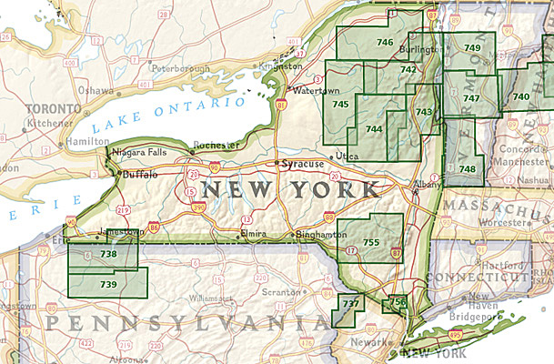
Coverage includes McKenzie Mountain and Sentinel Range Wilderness Areas; Raquette Boreal, Whitehill, Saranac Lakes, Debar Mountain and Taylor Pond Wild Forests; Saint Regis Canoe Area; Saint Regis Falls, Lyon Mountain, and Au Sable Forks.
The Adirondack Park Saranac/Paul Smiths map is designed and printed in the United States on durable synthetic paper, making it waterproof, tear-resistant, and trail tough – made to head outside and go anywhere you do. The map is two-sided, and is folded to a packable size of 4.25" x 9.25"; unfolded size is 26" x 38".
 
Key Features:
• Waterproof and tear-resistant
• Updated regularly
• Designed and printed in the U.S.A.
• Detailed road network, including designations for off-highway roads
• Clearly marked trails for hiking, canoeing biking, and more
• Detailed topography with shaded relief and clearly defined, color-coded boundaries for parks, recreation areas, wilderness areas, forest and primitive areas.
• Hundreds of places-of-interest, including campgrounds, information centers, trailheads, viewpoints, boat launches, canoe carry downs, fishing access points, ski areas, rock climbing, and specialty content unique to each area
• UTM and Latitude/Longitude coordinate grid, as well as selected waypoints, and a scale bar for easy and accurate navigation.

Reviews

Geen reviews gevonden voor dit product.

Schrijf een review

Graag horen wij wat u van dit artikel vindt. Vindt u het goed, leuk, mooi, slecht, lelijk, onbruikbaar of erg handig: schrijf gerust alles op! Het is niet alleen leuk om te doen maar u informeert andere klanten er ook nog mee!