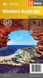
Wegenkaart - landkaart Western Australia state map | Hema Maps (9321438001553)
- ISBN / CODE: 9321438001553
- Editie: 01-11-2019
- Druk: 11
- Aantal blz.: 1
- Schaal: 1:2500000
- Uitgever: Hema Maps
- Soort: Wegenkaart
- Serie: State map
- Taal: Engels
- Hoogte: 25.0 cm
- Breedte: 14.0 cm
- Gewicht: 60.0 g
- Uitvoering: Papier
- Beoordeling: 4,0 ★★★★★ (1 review) Schrijf een review
-
€ 15,95
Dit artikel is (tijdelijk) niet leverbaar
Beschrijving
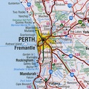
Goede, overzichtelijke, leesbare kaart van de hele provincie. Nationale Parken zijn er goed op te vinden en de afstanden worden weergegeven. Op de achterkant nog deelkaartjes van enkele steden en NP s.
Reviews
Prima kaart.
★★★★★ door Inge Staarman 8 maart 2017Vond u dit een nuttige review? (login om te beoordelen)
Schrijf een review
Graag horen wij wat u van dit artikel vindt. Vindt u het goed, leuk, mooi, slecht, lelijk, onbruikbaar of erg handig: schrijf gerust alles op! Het is niet alleen leuk om te doen maar u informeert andere klanten er ook nog mee!


