Wandelkaarten - Vogezen - Elzas - Lotharingen
Overzichtskaarten
-
Overzicht IGN 25.000 Elzas - Lotharingen: West

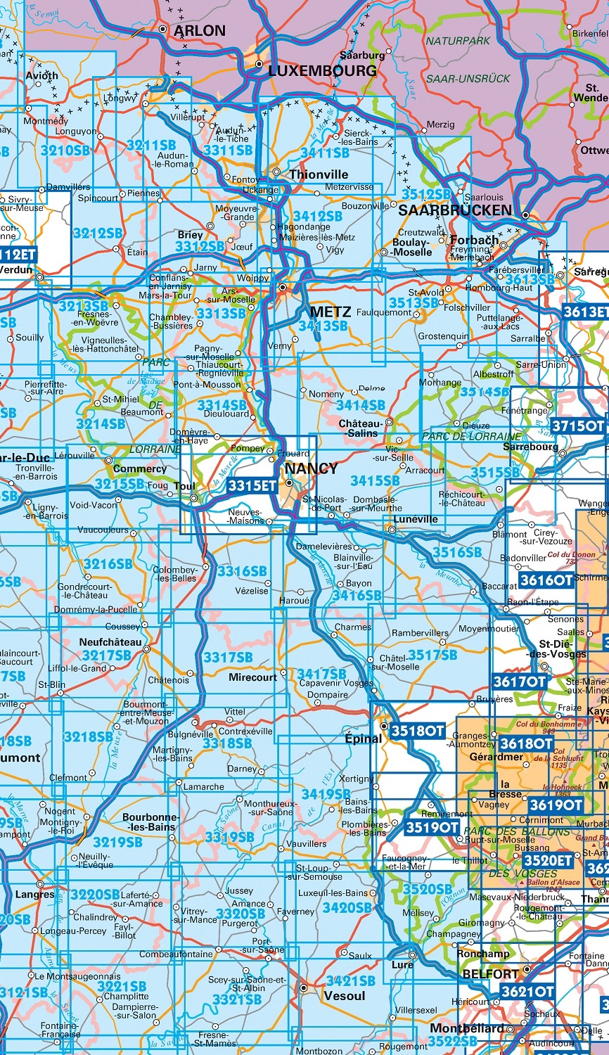
Producten op deze overzichtskaart:
Klik op een product om naar de pagina van dat product te gaan.
- Wandelkaart - Topografische kaart 3210 SB - Serie Bleue Longuyon | IGN - Institut Géographique National
- Wandelkaart - Topografische kaart 3211 SB - Serie Bleue Longuyon - Longwy | IGN - Institut Géographique National
- Wandelkaart - Topografische kaart 3212 SB - Serie Bleue Étain | IGN - Institut Géographique National
- Wandelkaart - Topografische kaart 3214 SB - Serie Bleue St-Mihiel | IGN - Institut Géographique National
- Wandelkaart - Topografische kaart 3311 SB - Serie Bleue Hayange, Villerupt, Audun-le-Roman | IGN - Institut Géographique National
- Wandelkaart - Topografische kaart 3312 SB - Serie Bleue Briey | IGN - Institut Géographique National
- Wandelkaart - Topografische kaart 3313 SB - Serie Bleue Ars-sur-Moselle | IGN - Institut Géographique National
- Wandelkaart - Topografische kaart 3314 SB - Serie Bleue Pont-à-Mousson | IGN - Institut Géographique National
- Topografische kaart - Wandelkaart 3315ET Nancy / Toul / Forêt de Haye | IGN - Institut Géographique National
- Wandelkaart - Topografische kaart 3316 SB - Serie Bleue Vézelise | IGN - Institut Géographique National
- Wandelkaart - Topografische kaart 3317 SB - Serie Bleue Chatenois | IGN - Institut Géographique National
- Topografische kaart - Wandelkaart 3318 SB - Serie Bleue Vittel | IGN - Institut Géographique National
- Wandelkaart - Topografische kaart 3411 SB - Serie Bleue Thionville | IGN - Institut Géographique National
- Wandelkaart - Topografische kaart 3412 SB - Serie Bleue Woippy | IGN - Institut Géographique National
- Wandelkaart - Topografische kaart 3413 SB - Serie Bleue Metz | IGN - Institut Géographique National
- Wandelkaart - Topografische kaart 3414 SB - Serie Bleue Château-Salins | IGN - Institut Géographique National
- Wandelkaart - Topografische kaart 3415 SB - Serie Bleue Saint-Nicolas-de-Port | IGN - Institut Géographique National
- Wandelkaart - Topografische kaart 3417 SB - Serie Bleue Mirecourt - Charmes | IGN - Institut Géographique National
- Wandelkaart - Topografische kaart 3419 Bains-les-Bains | IGN - Institut Géographique National
- Wandelkaart - Topografische kaart 3512 SB - Serie Bleue Bouzonville | IGN - Institut Géographique National
- Wandelkaart - Topografische kaart 3513 SB - Serie Bleue Saint-Avold / Faulquemont | IGN - Institut Géographique National
- Wandelkaart - Topografische kaart 3514 SB - Serie Bleue Dieuze / Albestroff | IGN - Institut Géographique National
- Wandelkaart - Topografische kaart 3515 SB - Serie Bleue Lorquin - Avricourt | IGN - Institut Géographique National
- Wandelkaart - Topografische kaart 3516 SB - Serie Bleue Lunéville / Baccarat | IGN - Institut Géographique National
- Wandelkaart - Topografische kaart 3517 SB - Serie Bleue Rambervillers | IGN - Institut Géographique National
- Wandelkaart - Topografische kaart 3518OT Epinal | IGN - Institut Géographique National
- Wandelkaart - Topografische kaart 3519OT Remiremont | IGN - Institut Géographique National
- Wandelkaart - Topografische kaart 3520 SB - Serie Bleue Mélisey - Lure | IGN - Institut Géographique National
- Wandelkaart - Topografische kaart 3613 SB - Serie Bleue Forbach - Sarreguemines | IGN - Institut Géographique National
-
Overzicht IGN 25.000 Vogezen en Elzas - Lotharingen: Oost

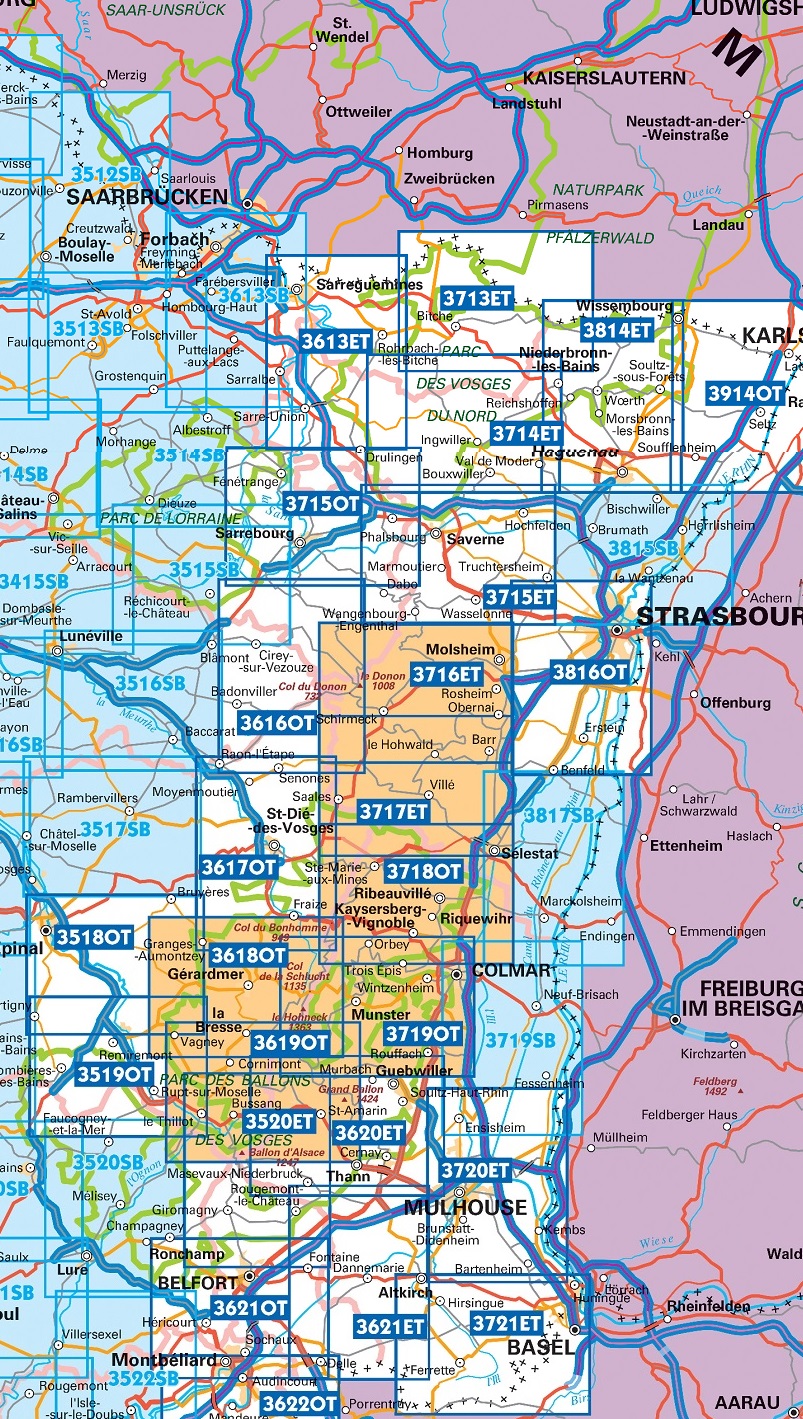
Producten op deze overzichtskaart:
Klik op een product om naar de pagina van dat product te gaan.
- Wandelkaart - Topografische kaart 3518OT Epinal | IGN - Institut Géographique National
- Wandelkaart - Topografische kaart 3519OT Remiremont | IGN - Institut Géographique National
- Wandelkaart - Topografische kaart 3520ET Ballon d'Alsace | IGN - Institut Géographique National
- Wandelkaart - Topografische kaart 3613ET Sarreguemines | IGN - Institut Géographique National
- Wandelkaart - Topografische kaart 3614ET Sarre-Union - Phalsbourg | IGN - Institut Géographique National
- Wandelkaart - Topografische kaart 3616OT Lac de Pierre-Percée - Le Donon | IGN - Institut Géographique National
- Wandelkaart - Topografische kaart 3617OT St-Dié-des-Vosges | IGN - Institut Géographique National
- Wandelkaart - Topografische kaart 3618OT Le Hohneck - Gérardmer | IGN - Institut Géographique National
- Wandelkaart - Topografische kaart 3619OT Bussang - La Bresse | IGN - Institut Géographique National
- Wandelkaart - Topografische kaart 3620ET Grand Ballon | IGN - Institut Géographique National
- Wandelkaart - Topografische kaart 3621ET Dannemarie - Delle - Sundgau | IGN - Institut Géographique National
- Wandelkaart - Topografische kaart 3713ET Pays de Bitche - Dambach - PNR des Vosges du Nord | IGN - Institut Géographique National
- Wandelkaart - Topografische kaart 3714ET la Petite Pierre - Petite Pierre, Niederbronn-les-Bains, PNR Vosges du Nord | IGN - Institut Géographique National
- Wandelkaart - Topografische kaart 3715ET Wasselone - Rocher de Dabo - Saverne | IGN - Institut Géographique National
- Wandelkaart - Topografische kaart 3715OT Sarrebourg - Phalsbourg - Pays des Etangs | IGN - Institut Géographique National
- Wandelkaart - Topografische kaart 3716ET le Donon, Obernai, Mont Ste-Odile | IGN - Institut Géographique National
- Wandelkaart - Topografische kaart 3717ET Barr - Le Howald - Villé - Vallée de la Bruche | IGN - Institut Géographique National
- Wandelkaart - Topografische kaart 3717ETR Barr / Le Howald / Villé / Hte Vallée de la Bruche | IGN - Institut Géographique National
- Wandelkaart - Topografische kaart 3718OT Selestat - Col Du Bonhomme | IGN - Institut Géographique National
- Wandelkaart - Topografische kaart 3719 SB - Serie Bleue Colmar | IGN - Institut Géographique National
- Wandelkaart - Topografische kaart 3719OT Colmar & Le Hohneck | IGN - Institut Géographique National
- Wandelkaart - Topografische kaart 3720ET Mulhouse | IGN - Institut Géographique National
- Wandelkaart - Topografische kaart 3721ET Altkirch - Bâle - Sundgau | IGN - Institut Géographique National
- Wandelkaart - Topografische kaart 3814ET Hagenau - Lembach - PNR des Vosges du Nord | IGN - Institut Géographique National
- Wandelkaart - Topografische kaart 3815 SB - Serie Bleue Bischwiller - Brumath | IGN - Institut Géographique National
- Wandelkaart - Topografische kaart 3816OT Strasbourg | IGN - Institut Géographique National
- Wandelkaart - Topografische kaart 3817 SB - Serie Bleue Sélestat - Marckolsheim | IGN - Institut Géographique National
- Wandelkaart - Topografische kaart 3914OT Wissembourg | IGN - Institut Géographique National
-
Overzicht Outdoorkarte FR Kummerly + Frey 1:35000 & 1:50.000
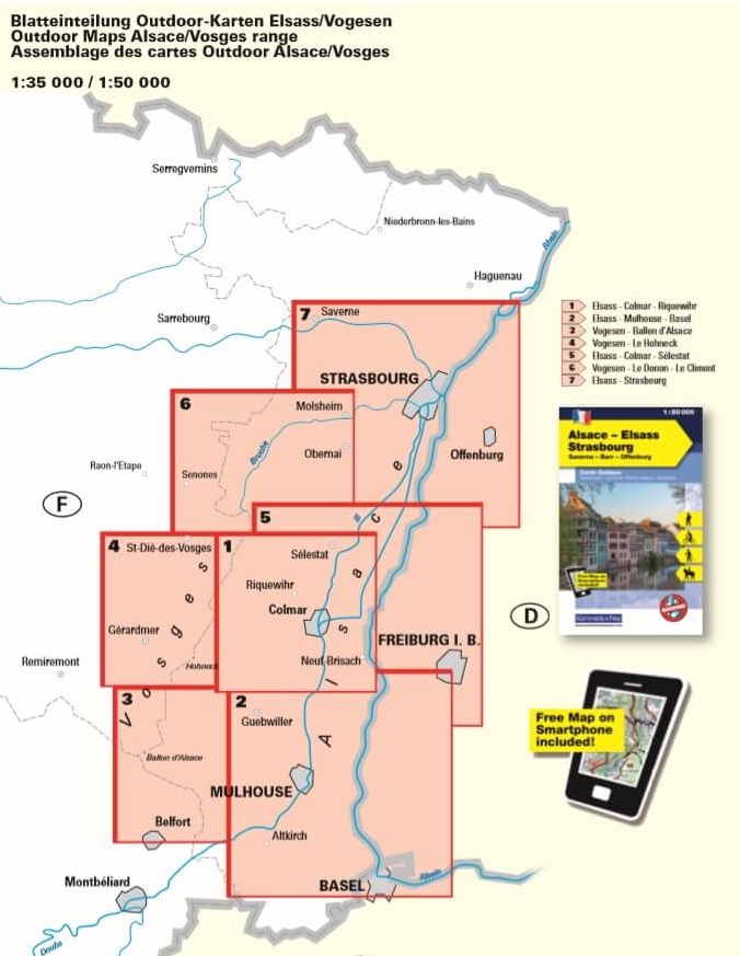
Producten op deze overzichtskaart:
Klik op een product om naar de pagina van dat product te gaan.
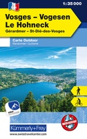 Wandelkaart 4 Outdoorkarte FR Vogesen - Vosges - Le Hohneck - Vogezen | Kümmerly & Frey
Hele goede wandelkaart met alle noodzakelijke topografische details, hoogtelijnen, ingetekende wandelroutes en hutten, mountainbikeroutes en fietsroutes - de kaart is geplastificeerd. De vakantie-kaarten van Kümmerly + Frey zijn de …
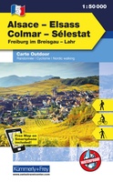 Wandelkaart 5 Outdoorkarte FR Elsass - Colmar - Sélestat - Elzas | Kümmerly & Frey
Hele goede wandelkaart met alle noodzakelijke topografische details, hoogtelijnen, ingetekende wandelroutes en hutten, mountainbikeroutes en fietsroutes - de kaart is geplastificeerd. De vakantie-kaarten van Kümmerly + Frey zijn de …
 Wandelkaart 89032 Traversée du Massif des Vosges GR5 - GR53 Vogezen | IGN - Institut Géographique National
Traversée du massif des Vosges Schaal 1 : 100 000 gevouwen kaart (dubbelzijdig, scheurvast en waterdicht) GR 5 en GR 53 en andere wandelroutes GPS-compatibel plan je etappes …
 Topografische kaart - Wandelkaart 3315ET Nancy / Toul / Forêt de Haye | IGN - Institut Géographique National
De wandelkaart die de perfectie benadert! Werkelijk alle topografische details zijn er op te vinden; van hoogtelijnen tot aan bruggetjes en allerlei wandelpaden. Daarnaast hebben de makers een flinke dosis …
Laatste reviews

Mooie landkaart en snel bezorgd
★★★★★ door Rene van Paasen 16 december 2024 | Heeft dit artikel gekocht
Als er één ding is waardoor de Blue Guides bekendheid genieten, dan is het wel de vele aandacht voor cultuur. Zo ook deze. Ik krijg …
★★★★★ door Christine Grit 13 december 2024 | Heeft dit artikel gekocht
De coördinaten op de kaart zijn onbruikbaar. Je kan deze niet gebruiken met een kaarthoekmeter. Er is geen getekende grid voor de coördinaten. Kaart is …
★★★★★ door Robin 13 december 2024 | Heeft dit artikel gekocht
De coördinaten op de kaart zijn onbruikbaar. Je kan deze niet gebruiken met een kaarthoekmeter. Er is geen getekende grid voor de coördinaten. Kaart is …
★★★★★ door Robin 13 december 2024 | Heeft dit artikel gekocht


