Schotland
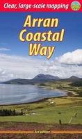 Wandelgids The Arran Coastal Way | Rucksack Readers
The Arran Coastal Way is perhaps Scotland's finest circular long-distance trail, running 65 miles (105 km) around the Isle of Arran in a memorable week-long hike from Brodick. It's accessible …
★★★★★★★★★★ Wegenkaart - landkaart Whisky map of Scotland | Collins
Wegenkaart met meer dan 100 distilleerderijen en whisky gerelateerde locaties. Discover where Scotland’s national drink is produced. All of Scotland’s operational whisky distilleries and whisky-related places of interest located …
★★★★★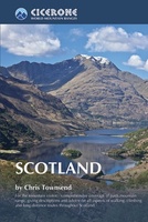 Wandelgids Scotland | Cicerone
Als je wilt wandelen in Schotland is dit het ultieme naslagwerk. A resource book covering the finest walks and climbs in Scotland, with its variety of wild landscapes ranging from …
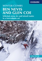 Klimgids - Klettersteiggids Winter Climbs Ben Nevis and Glencoe - Scotland | Cicerone
Ben Nevis and Glen Coe remain at the forefront of Scottish winter climbing and hold their place on the world stage of climbing. The classic climbs are highly regarded objectives. …
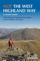 Wandelgids NOT the west Highland Way | Cicerone
The West Highland Way from Glasgow to Fort William is one of the finest UK long distance paths, but it runs close to a busy main road and avoids the …
★★★★★ Wegenkaart - landkaart - Stadsplattegrond Edinburgh & Southern Scotland | ITMB
Plattegrond van Edinburgh, schaal 1:10.000, met op de achterzijde een overzichtskaart van zuid Schotland, schaal 1:370.000. Legend Includes: Roads by classification, Airports, Ferry lines, Railways, Railway stations, Bus terminals, Bicycle …
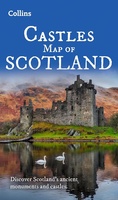 Wegenkaart - landkaart Castles map of Scotland - Schotland kastelen | Collins
Kaart waarop meer dan 700 kastelen in Schotland staan aangegeven. Discover Scotland's ancient monuments and castles. Explore Scotland’s ancient monuments with this pictorial map featuring over 700 castles and fortified …
★★★★★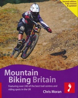 Mountainbikegids Handbook Mountain Biking Britain ( Engeland - Schotland) | Footprint
Experienced Footprint author Chris Moran (co-author of Mountain Biking Europe and Snowboarding the World) brings you the fully revised & updated guide to mountain bike riding in Britain. Mountain Biking …
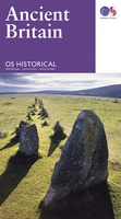 Wegenkaart - landkaart Ancient Britain | Ordnance Survey
The Ordnance Survey Ancient Britain map is a comprehensive guide to the most important archaeological sites of early English, Welsh and Scottish history. Ordnance Survey's Ancient Britain map shows Neolithic, …
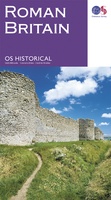 Wegenkaart - landkaart Roman Britain | Ordnance Survey
An informative map showing the location of the most important ancient monuments of Roman Britain. The map has been produced by Ordnance Survey in collaboration with the Ancient Monument Trusts …
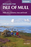 Wandelgids Isle of Mull | Cicerone
Uitstekende wandelgids voor dit uitdagende wandelgebied in Schotland. Met goede topografische deelkaarten. Guidebook describing over 40 walking routes on Scotland's beautiful Isle of Mull, as well as neighbouring Ulva, Gometra, …
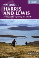 Wandelgids Harris and Lewis – Outer Hebrides, Hebriden Schotland | Cicerone
Uitstekende wandelgids van dit geweldige gebied. goed beschreven met veel praktische informatie om de route te kunnen lopen, inclusief goede kaarten. This guidebook describes 30 day walks all over the …
★★★★★ Campinggids The Caravan & Camping Guide Britain 2025 | AA Publishing
Uitgebreide gids met campings om met de tent of de caravan naar toe te gaan. 580 campings in Engeland, Schotland, Noord-Ierland, Wales, Kanaaleilanden, Isle of Man en de Schotse eilanden. …
★★★★★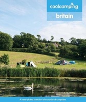 Campinggids Cool Camping Britain | Punk Publishing
Cool Camping Britain is een fantastisch idee: zowel een koffietafel boek als een campinggids. Het bewijs dat de tijd van saaie campingidsen voorbij is! Prachtig vormgegeven, maar tevens inhoudelijk belangrijk …
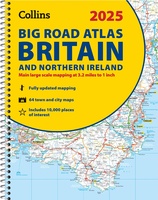 Wegenatlas Big Road Atlas Britain and Northern Ireland 2025 | A3 | Ringband | Collins
Grote wegenatlas, a3-formaat in ringband. The ultimate 3.2 miles to 1 inch scale large-format, spiral-bound road atlas of Britain, featuring Collins’ popular and well established road mapping, and designed for …
★★★★★★★★★★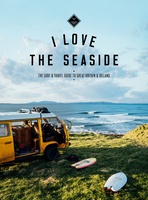 Reisgids I love the seaside Great Britain - Ireland, Groot Brittannie en Ierland | Mo'Media | Momedia
The I Love the Seaside Surf & Travel Guide to Great Britain & Ireland is a 464-page printed book (English language) exploring the (surf) coast of Britain and Ireland. From …
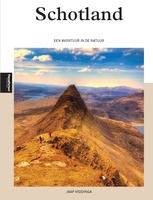 Reisgids PassePartout Schotland - een avontuur in de natuur | Edicola
Schotland, een land van ongerepte natuur met mistige hooglanden, woeste bergen, diepblauwe meren, prachtige valleien met watervallen, uitgestrekte bossen, heidevelden en een geweldige flora en fauna. In de 40 jaar …
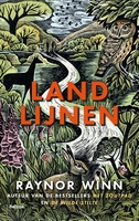 Reisverhaal Landlijnen | Raynor Winn
In haar unieke, beeldende, empathische stijl, doet bestsellerauteur Raynor Winn in het spectaculaire Landlijnen verslag van de zwaarste wandeltocht die zij en haar man Moth tot nu toe ondernamen. Te …
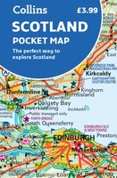 Wegenkaart - landkaart Pocket Map Scotland | Collins
Handy little full colour map of Scotland. Excellent value and very detailed for its size. Double-sided folded map with the Central Belt, southern Scotland and northern England on one side …
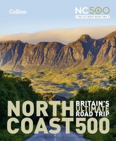 Reisgids North Coast 500 NC500 | Collins
Highly illustrated, full colour book showcasing what is unique about the North Coast 500. Striking images and descriptive text of the best places to visit are shown along with a …
★★★★★
Laatste reviews

Heb de gids cadeau gedaan en die persoon was er heel blij mee ..
★★★★★ door J 21 november 2024 | Heeft dit artikel gekocht
De kaart van Kirgystan is prachtig, zeer gedetailleerd. Kan niet wachten tot de we echt op reis hmgaan die kant op.
★★★★★ door Marijke Eering 21 november 2024 | Heeft dit artikel gekocht
Super handig fiets boekje en mooi water bestendig. En handig om op de kaarten te kijken heel duidelijk beschrijving. Wij fietsen al jaren in Duitsland …
★★★★★ door Jenneke holterman 19 november 2024 | Heeft dit artikel gekocht
prima kaart levering en betaling allemaal vlot verlopen
★★★★★ door Marc Buts 19 november 2024 | Heeft dit artikel gekocht


