
Wegenkaarten - Schotland
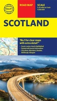 Wegenkaart - landkaart Philip's Scotland Road Map | Philip's Maps
'THE CLEAREST AND MOST DETAILED MAPS OF EUROPE' David Williams MBE, former CEO Gem Motoring Assist The bestselling fold-out road map for navigating in Scotland has been updated for all …
★★★★★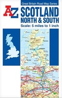 Wegenkaart - landkaart Scotland North & South | A-Z Map Company
The Great Britain Road Map series comprises of five fold-out sheet maps which together cover the whole of Great Britain. Shown at a scale of 5 miles to 1 inch, …
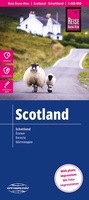 Wegenkaart - landkaart Schotland | Reise Know-How Verlag
Tweetalige kaart (Engels en Duits). Door ingetekende lengte- en breedtegraden is het gebruik van GPS mogelijk. Met hoogtelijnen en uitgebreid wegennetwerk: daarnaast worden ook de afstanden tussen belangrijke plaatsen duidelijk …
★★★★★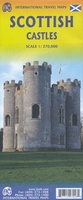 Wegenkaart - landkaart Scottisch Castles & Whisky Distilleries | ITMB
Een speciale versie van de ITMB wegenkaart van Schotland, naast de gebruikelijke aanduidingen van o.a. nationale parken en vliegvelden worden ook kastelen en whisky distilleerderijen op de kaart weergegeven. What …
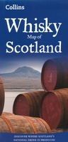 Wegenkaart - landkaart Whisky map of Scotland | Collins
Wegenkaart met meer dan 100 distilleerderijen en whisky gerelateerde locaties. Discover where Scotland’s national drink is produced. All of Scotland’s operational whisky distilleries and whisky-related places of interest located …
★★★★★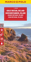 Wegenkaart - landkaart Great Britain & Ireland - Groot Brittannië & Ierland | Marco Polo
Duidelijke wegenkaart van Marco Polo: alle wegen, zowel de verharde als belangrijke onverharde wegen zijn weergegeven. Mooie toeristisch interessante wegen die de moeite waard zijn, zijn groen gearceerd. Veel toeristische …
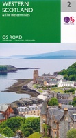 Wegenkaart - landkaart 2 OS Road Map Western Scotland & the Western Isles | Ordnance Survey
Een serie uitstekende wegenkaarten van Ordnance survey, de topografische dienst van Engeland. Alle 8 delen kennen een schaal van 1:250.000. Het kleurgebruik is uitbundig maar niet storend; integendeel, de hoogtes …
★★★★★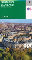 Wegenkaart - landkaart 3 OS Road Map Southern Scotland & Northumberland | Ordnance Survey
Een serie uitstekende wegenkaarten van Ordnance survey, de topografische dienst van Engeland. Alle 8 delen kennen een schaal van 1:250.000. Het kleurgebruik is uitbundig maar niet storend; integendeel, de hoogtes …
★★★★★★★★★★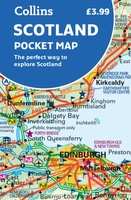 Wegenkaart - landkaart Pocket Map Scotland | Collins
Handy little full colour map of Scotland. Excellent value and very detailed for its size. Double-sided folded map with the Central Belt, southern Scotland and northern England on one side …
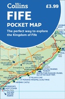 Wegenkaart - landkaart Pocket Map Fife | Collins
Handy little full colour map of the coastal Kingdom of Fife. Detailed mapping and tourist information from Dundee in the North to Edinburgh in the south and from Fife coast …
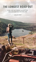 Wegenkaart - landkaart Routemap The Longest Road Out | Longestroadout
Deze kaart hoort bij het boek The Longest Road Out
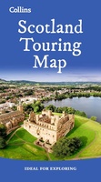 Wegenkaart - landkaart Touring Map of Scotland - Schotland | Collins
Best-selling map of Scotland. More than 1,000 places of tourist interest plotted and named on the map. The features have been plotted onto an up-to-date and attractive Collins map of …
★★★★★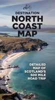 Wegenkaart - landkaart North Coast Road Trip Map | Destination Earth
This North Coast road trip map is the essential tool that will guide you through the breathtaking landscapes, stunning coastal views, and enchanting villages of the North Coast 500 in …
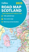 Wegenkaart - landkaart Scotland - Schotland road map 2025 | Collins
Explore Scotland with easy-to-read mapping from Collins. Full-color map of Scotland at 8.7 miles to 1 inch (1:550.000), with clear road network and administrative areas shown in color. The map …
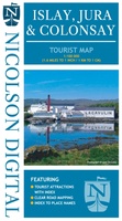 Wegenkaart - landkaart Islay, Jura & Colonsay Tourist Map | Nicolson
Nicolson Digital Tourist Maps are ideal for planning your visit to some of the most beautiful areas of Scotland. Tourist attractions and places are clearly marked. Topography is shown through …
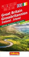 Wegenkaart - landkaart Grossbritannien, Irland - Groot Britannie, Ierland | Hallwag
Prima kaart van heel Groot Brittannie en Ierland , dubbelzijdig bedrukt met plaatsnamen index. Road map Great Britain / Ireland Road map with transit plans, location index, tourist information and …
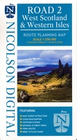 Wegenkaart - landkaart West Scotland - Western ISles - Schotland | Nicolson
Based on the Ordnance Survey 1/250000 Road mapping. Road Map 2 covers West Scotland & the Western Isles. Please scroll through the images to see the area of coverage …
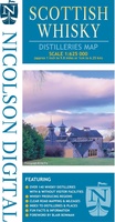 Wegenkaart - landkaart Scottish Whisky Distilleries Map | Schotse whiskystokerijen | Nicolson
Our brand new and up to date whisky map shows over 150 distilleries on our exceptionally clear road mapping, allowing you to navigate to your chosen destination. Enlarged inset map …
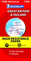 Wegenkaart - landkaart 798 Great Britain & Ireland | Michelin
Scheur- en watervast! Zoals je van Michelin mag verwachten is deze kaart zeer overzichtelijk en heeft een duidelijk helder kaartbeeld. De kaart geeft uitgebreid toeristische informatie weer. Met register, …
 Wegenkaart - landkaart Visitors map Scotland - Schotland | A-Z Map Company
xplore the whole of Scotland from Dumfries and Galloway in the South to the Orkney Islands in the North. With detailed road mapping and illustrated town plans of major cities, …
Laatste reviews

Duidelijke kaart, ook met kleinere wegen. Snelle levering
★★★★★ door Ger Sulkers 02 mei 2024 | Heeft dit artikel gekocht
Ja wij zijn tevreden, alleen is mijn vriendin het boekje al kwijtgeraakt bij onze eerste wandeling.🙁
★★★★★ door Mark 02 mei 2024 | Heeft dit artikel gekocht
Ja ik ben dik tevreden over de wegenkaart van Kazachstan. Stond alles op wat ik wou dus heel erg tevreden daarover.
★★★★★ door Sjoerd Westra 02 mei 2024 | Heeft dit artikel gekocht
Zoals altijd mooie verzorgde kaarten die tijdens de reis van pas komen en achteraf mooie herinneringen oproepen.
★★★★★ door Klaas Wijnberg 02 mei 2024 | Heeft dit artikel gekocht