
Kaarten - British Columbia
 Wegenkaart - landkaart Vancouver's North Shore Hiking Trails - Fraser Valley | ITMB
Our popular map showing the recreational hiking trails in the mountains within the urban area of Metro Vancouver, but outside of its urbanized limits, continues into its most recent printing …
 Wegenkaart - landkaart Canada west - Kanada west | Reise Know-How Verlag
Tweetalige kaart (Engels en Duits). Door ingetekende lengte- en breedtegraden is het gebruik van GPS mogelijk. Met hoogtelijnen en uitgebreid wegennetwerk: daarnaast worden ook de afstanden tussen belangrijke plaatsen duidelijk …
★★★★★ Wegenkaart - landkaart Gulf Islands & Nanaimo (Canada) | ITMB
This is completely new artwork and a new approach to ITMB’s mapping of the islands in the Gulf of Georgia, between the mainland and Vancouver Island. This double-sided map incorporates …
 Wegenatlas Travel Atlas British Columbia | ITMB
Wegenatlas in handig A5 formaat. De schaal is verschillend; het zuiden in 1:925.000 en het noorden van deze staat 1: 1.250.000. Prettig leesbaar. BC is the most visited province of …
★★★★★ Wegenkaart - landkaart 92G Lower Mainland British Columbia - Richmond and New Westminster | ITMB
Goede wegenkaart van British Columbia met topografische uitsnede van Richmond en Westminster. Topographic/Recreation Map 92G&92G2 and G3 - With the 2010 Winter Olympics bearing down on us, this very timely …
 Wegenkaart - landkaart British Columbia South (Canada) | ITMB
Deze wegenkaart van British Columbia bestrijkt het gebied tussen Vancouver en Calgary, en is de perfecte toeristische kaart voor het verkennen van de regio Rocky Mountain. Alle wegen en spoorlijnen …
★★★★★★★★★★ Wegenkaart - landkaart Canada west | Hildebrand's
Goede overzichtskaart van Westelijk Canada op redelijke schaal. Het is een tweezijdige kaart, waarbij het noordelijk deel op de ene kant en het zuidelijke - meest gebruikte - deel op …
★★★★★★★★★★ Topografische kaart 82 N&K Canadian Rockies Banff, Kootenay, Yoho Parks | ITMB
1:250,000 scale, 1st Edition, 2008 – This is a fabulous map. The artwork consists of four complete Govt. of Canada Topographic maps (82J, K, N, and O) overprinted with hundreds …
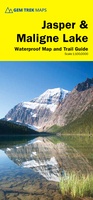 Wandelkaart 01 Jasper National Park & Maligne Lake | Gem Trek Maps
Scheur- en Watervast papier Gem Trek’s JASPER AND MALIGNE LAKE MAP map is designed for outdoor enthusiasts looking to explore the section of Jasper National Park near the town and …
★★★★★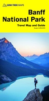 Wegenkaart - landkaart 01 Banff National Park | Gem Trek Maps
Handige uitvouwbare folder met goede kaart van schaal 1:250.000. Op de achterzijde staat heel veel info over geschiedenis, bezienswaardigheden, natuur en geologie. This user-friendly map-guide includes a 1:250,000-scale poster-quality map …
★★★★★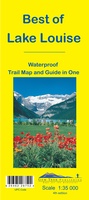 Wandelkaart 13 Best of Lake Louise Map and Guide | Gem Trek Maps
Mooie, gedetailleerde kaart uit de serie van Gem Trek Hiking map-guides, van het gebied Lake Louise. Helder kleurgebruik en met de beste / mooiste wandelroutes, hikes, fietsroutes, autoroutes en interessante …
★★★★★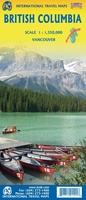 Wegenkaart - landkaart British Columbia | ITMB
Wegenkaart van alleen British Columbia. Calgary in het oosten staat er nog net op. Met campsites, register en nationale parken. This is our eight printing of our most popular provincial …
★★★★★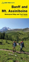 Wandelkaart 05 Banff National Park and Mt. Assiniboine | Gem Trek Maps
This map covers the most popular hiking and mountain biking terrain in Banff National Park, from Lake Louise in the north to the south end of Banff National Park, plus …
★★★★★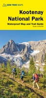 Wandelkaart 10 Kootenay National Park | Gem Trek Maps
This map covers all of Kootenay National Park, from Castle Mountain Junction south through Radium, to Windermere. All the official hiking and mountain biking trails in Kootenay National Park …
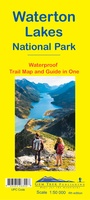 Wandelkaart 16 Waterton Lakes NP | Gem Trek Maps
The Waterton Lakes National Park map is one of our most popular trail map-guides for the Canadian Rockies. This map covers all of Waterton Lakes National Park, the eastern end …
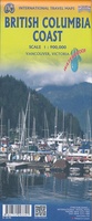 Wegenkaart - landkaart British Colombia Coast | ITMB
Een degelijke kaart met aanduidingen van o.a. nationale parken, vliegveld, benzinepomp, dirt-roads en kleine plattegrond van hoofdstad. As overzichtskaart goed te gebruiken. The home of the Haida nation is located …
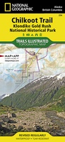 Wandelkaart - Topografische kaart 254 Chilkoot Trail | National Geographic
Prachtige geplastificeerde kaart van het nationaal park. Met alle recreatieve voorzieningen als campsites, maar ook met topografische details en wandelroutes ed. Door uitgekiend kleurgebruik zeer prettig in gebruik. Scheur en …
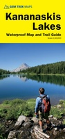 Wandelkaart 07 Kananaskis Lakes | Gem Trek Maps
This map covers what some say is the most scenic terrain in all of Kananaskis Country - the upper Smith-Dorrien-Spray Trail south of Mt. Shark, Peter Lougheed Provincial Park including …
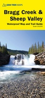 Wandelkaart 08 Bragg Creek and Sheep Valley | Gem Trek Maps
Gem Trek’s BRAGG CREEK & SHEEP VALLEY MAP is for hikers and outdoor enthusiasts looking to explore Kananaskis Country west and south of Bragg Creek. Whether you are touring along …
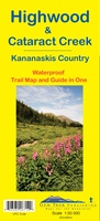 Wandelkaart 09 Highwood & Cataract Creek | Gem Trek Maps
Gedetailleerde kaart van dit prachtige gebied; deze kaart is geplastificeerd, scheur- en watervast. Gem Trek’s Highwood & Cataract Creek map meets the needs of visitors looking to explore the southern …
Laatste reviews

Heel blij met de kaart geweest, uiteindelijk wel 5 keer per dag in handen gehad tijdens mijn tocht. Gebruikersvriendelijk en dankzij platsificeering ook uiterst geschickt …
★★★★★ door Jasmin 16 mei 2024 | Heeft dit artikel gekocht
Snelle levering
★★★★★ door Pierre 16 mei 2024 | Heeft dit artikel gekocht
Snelle levering
★★★★★ door Pierre Dilissen 16 mei 2024 | Heeft dit artikel gekocht
Na een tijdje zoeken heb ik deze kaart van Sierra Espuña gevonden. De kaart is niet zo mooi als een Kompass kaart maar naar mijn …
★★★★★ door Joram 15 mei 2024 | Heeft dit artikel gekocht