
Wegenatlassen - Europa
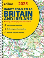 Wegenatlas 2025 Collins Handy Road Atlas Britain and Ireland | Collins
Handzame A5 wegenatlas van Engeland, Wales, Schotland en Ierland met register en stadsplattegronden This easy-to-use, handy A5 sized road atlas with popular lie-flat spiral binding features extremely clear route planning …
★★★★★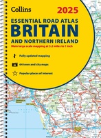 Wegenatlas Essential Road Atlas Britain 2025 | A4 | Ringband | Collins
This A4 road atlas with lie-flat spiral binding provides clear and detailed road mapping for England, Wales and Southern Scotland at a scale of 3.2 miles to 1 inch (1:200,000). …
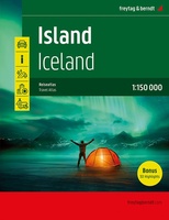 Wegenatlas Island - IJsland | Freytag & Berndt
Bijzonder gedetaileerde wegenatlas van IJsland . Handig in ringband. Der Reiseatlas Island 1:150.000 ist der ideale Wegbegleiter für alle, die Island mit dem Auto oder öffentlichen Verkehrsmitteln erkunden möchte. Er …
★★★★★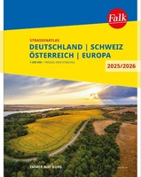 Wegenatlas Falk Straßenatlas 2025-2026 Deutschland, Österreich, Schweiz 1:300 000 | Falk Ostfildern
Der Falk Straßenatlas Deutschland wird ergänzt durch die beiden angrenzenden Reiseländer Österreich und Schweiz. In dem Detailmaßstab 1:300 000 sind selbst kleine Orte zu finden.Die praktische Spiralbindung sorgt zusätzlich für …
 Wegenatlas Big Easy Read Britain 2024 | A3 | Ringband | AA Publishing
AA Publishing brings you the UK’s most up-to-date road atlases Over 100 years of mapping your journeys • Giant scale mapping at 2.5 miles to 1 inch = 1:25,000 • …
 Wegenatlas Road Atlas Britain and Ireland 2024 | Philip's Maps
Let op! Ierland en een gedeelte van Schotland hebben een andere schaal dan de rest van de atlas. PHILIP'S - Market leaders and No. 1 in the UK for …
★★★★★ Wegenatlas Großer Alpenstraßenführer, 28. Ausgabe | Denzel Verlag
Das international bewährte Standardwerk für sportlich-touristisch eingestellte Auto- und Zweiradfahrer! Aus der Vielzahl anfahrbarer Hochpunkte innerhalb des weiten Alpenbogens von Wien bis Marseille wurden rund 700 der interessantesten Hochstraßen und …
 Wegenatlas Big Road Atlas Britain 2025 - A3 | Ringband | AA Publishing
This best-selling A3 format atlas is available in two binding styles; paperback and spiral bound. Up-to-date mapping from the experts at the AA this atlas has large 3 miles to …
★★★★★ Wegenatlas Scotland - Schotland | A-Z Map Company
Handzame gedetailleerde wegenatlas van Schotland. Navigate your way around Scotland with this detailed, full-colour and easy-to-use A-Z Road Atlas. From the border to the north coast, the mainland pages scale …
★★★★★ Wegenatlas Road Atlas Ireland - Ierland | AA Publishing
Handige wegenatlas van Ierland en Noord-Ierland, schaal 1:200.000. Met 10 stadsplattegronden: Belfast, Cork, Londonderry, Dublin, Galway, Killarney, Kilkenny, Limerick, Sligo and Waterford. Created from brand new mapping data, this atlas …
★★★★★ Stadsplattegrond - Wegenatlas Wien - Wenen atlas | Freytag & Berndt
 Wegenatlas Discovery Dublin city center atlas pocket | Ordnance Survey Ireland
 Wegenatlas Dublin official city & district street guide spiral | Ordnance Survey Ireland
Navigate your way around Dublin with confidence with the Official Dublin City & District Street Guide. Find your way around Ireland’s vibrant, historic capital with an enlarged city centre map …
 Wegenatlas Atlas der Alpen | Freytag & Berndt
 Wegenatlas Europa compact atlas | Freytag & Berndt
 Wegenatlas Großbritannien - Nordirland - Groot Brittanië & Noord Ierland | A4 | Ringband | Freytag & Berndt
 Wegenatlas Lielais Latvijas atlants - Letland | Jana Seta
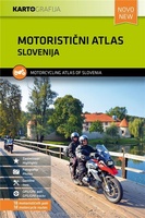 Wegenatlas Slovenia Motorcycle atlas - 18 routes | Kartografija
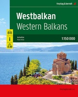 Wegenatlas Westbalkan | Ringband | Freytag & Berndt
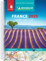 Wegenatlas Frankrijk atlas routier et touristique 2025 - klein formaat | Michelin
Klein formaat (A5, 17 x 23 cm) van de Atlas Routier et Touristique 2024 handig in gebruik door het formaat en ook nog in een ringband. Door het kleine formaat …
Laatste reviews

Heb de gids cadeau gedaan en die persoon was er heel blij mee ..
★★★★★ door J 21 november 2024 | Heeft dit artikel gekocht
De kaart van Kirgystan is prachtig, zeer gedetailleerd. Kan niet wachten tot de we echt op reis hmgaan die kant op.
★★★★★ door Marijke Eering 21 november 2024 | Heeft dit artikel gekocht
Super handig fiets boekje en mooi water bestendig. En handig om op de kaarten te kijken heel duidelijk beschrijving. Wij fietsen al jaren in Duitsland …
★★★★★ door Jenneke holterman 19 november 2024 | Heeft dit artikel gekocht
prima kaart levering en betaling allemaal vlot verlopen
★★★★★ door Marc Buts 19 november 2024 | Heeft dit artikel gekocht