■ York
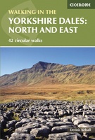 Wandelgids The Yorkshire Dales - Walking in the North and East | Cicerone
This guidebook contains 43 circular day walks in the north and east Yorkshire Dales. It explores the dales, hills and moors between Kirkby Stephen and Pateley Bridge. Walking ranges from …
 Wandelkaart - Topografische kaart OL02 OS Explorer Map Yorkshire Dales - Southern & Western Area | Ordnance Survey
Een van de beste detailkaarten die er op de wereld gemaakt worden: zeer gedetailleerd, prachtig helder kleurgebruik, veel topografische aspecten en - zeer belangrijk - allerlei toeristische en recreatieve aspecten …
★★★★★ Wandelkaart - Topografische kaart OL19 OS Explorer Map Howgill Fells and Upper Eden Valley | Ordnance Survey
Een van de beste detailkaarten die er op de wereld gemaakt worden: zeer gedetailleerd, prachtig helder kleurgebruik, veel topografische aspecten en - zeer belangrijk - allerlei toeristische en recreatieve aspecten …
 Wandelkaart - Topografische kaart OL26 OS Explorer Map North York Moors - Western area | Ordnance Survey
Een van de beste detailkaarten die er op de wereld gemaakt worden: zeer gedetailleerd, prachtig helder kleurgebruik, veel topografische aspecten en - zeer belangrijk - allerlei toeristische en recreatieve aspecten …
★★★★★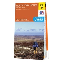 Wandelkaart - Topografische kaart OL27 OS Explorer Map North York Moors - Eastern area | Ordnance Survey
Een van de beste detailkaarten die er op de wereld gemaakt worden: zeer gedetailleerd, prachtig helder kleurgebruik, veel topografische aspecten en - zeer belangrijk - allerlei toeristische en recreatieve aspecten …
★★★★★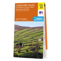 Wandelkaart - Topografische kaart OL30 OS Explorer Map Yorkshire Dales - Northern & Central Area | Ordnance Survey
Een van de beste detailkaarten die er op de wereld gemaakt worden: zeer gedetailleerd, prachtig helder kleurgebruik, veel topografische aspecten en - zeer belangrijk - allerlei toeristische en recreatieve aspecten …
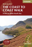 Wandelgids Coast to Coast Walk, From St Bees to Robin Hood's Bay | Cicerone
De beschrijving van de klassieke kust naar kust wandeling in het noorden van Engeland. Een van de mooiste en meest afwisselende wandeltochten van heel Engeland. Inclusief gidsje met routekaarten van …
★★★★★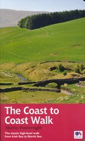 Wandelgids Coast to Coast Walk - van Ierse Zee tot Noordzee | Aurum Press
Goede gids over dit inmiddels beroemde pad. Kaartmateriaal is perfect, alsmede achtergrondinformatie. Praktische info wat minder, maar die is op de ramblerssite op internet te vinden! The Coast to Coast …
 Wandelkaart Pennine Way South | Harvey Maps
Mooie, duidelijke kaart van het zuidelijke gedeelte van de Pennine Way (Edale to Middleton-in-Teesdale). The whole of the Pennine Way on just 2 maps! Pennine Way South map covers …
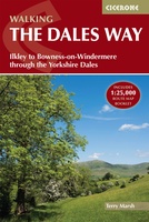 Wandelgids The Dales Way | Cicerone
A fully waymarked trail from Ilkley to Bowness-on-Windermere, the Dales Way links two of England's most celebrated national parks, the Yorkshire Dales and the Lake District. Well served for accommodation …
★★★★★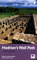 Wandelgids Hadrian's Wall Path | Aurum Press
Beschrijving van Hadrian's Wall Path. Historische en culturele aspecten komen vrij uitgebreid aan bod, praktische informatie is wel summier. Kaartmateriaal van Ordnance Survey is zonder meer uitstekend! Since it opened …
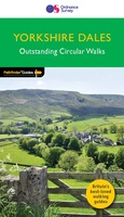 Wandelgids 015 Pathfinder Guides Yorkshire Dales | Ordnance Survey
Wandelgids van een deel van Engeland. Deze gids bevat 28 dagwandelingen, variërend van korte tochten tot pittige dagtochten. De bijbehorende kaarten zijn uitstekend: men heeft de topografische kaarten van Ordnance …
 Wandelkaart Cleveland Way | Harvey Maps
Mooie, duidelijke kaart van de Cleveland Way in Noord-Engeland. Geplastificeerd met veel extra informatie en uitsnedes van de route. Leap forward in technical excellence. Tough, light and 100% waterproof …
★★★★★ Wandelkaart Dales Way | Harvey Maps
Mooie, duidelijke kaart van de Dales Way in Noord-Engeland. Geplastificeerd met veel extra informatie en uitsnedes van de route. A leap forward in technical excellence: Tough, durable and 100% …
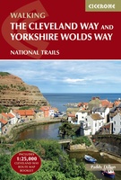 Wandelgids The Cleveland way and the Yorkshire Wolds way | Cicerone
Uitstekende wandelgids van de Cotswolds Way, waarbij naast alle noodzakelijke informatie ook gebruik gemaakt wordt van de echte topografische kaart. Inclusief gidsje met routekaarten van 1:25000 Guidebook to the Cleveland …
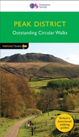 Wandelgids 063 Pathfinder Guides Peak District | Ordnance Survey
Wandelgids van een deel van Engeland, Schotland of Wales. Deze gids bevat 28 dagwandelingen, variërend van korte tochten tot pittige dagtochten. De bijbehorende kaarten zijn uitstekend: men heeft de topografische …
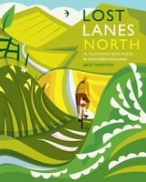 Fietsgids Lost Lanes North | Wild Things Publishing
Jack Thurston, best-selling author of the Lost Lanes series (50,000 sold) and presenter of the Bike Show, takes you on a freewheeling tour of the lost lanes and forgotten byways …
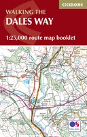 Wandelatlas The Dales Way Map Booklet | Cicerone
Heel handig bedacht van uitgever Cicerone: een boekje dat dienst doet als atlas met alle topografische kaarten die je nodig hebt voor het lopen van de Dales Way. Past goed …
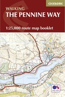 Wandelatlas Pennine Way Map Booklet | Cicerone
Heel handig bedacht van uitgever Cicerone: een boekje dat dienst doet als atlas met alle topografische kaarten die je nodig hebt voor het lopen van de Pennine Way. Past goed …
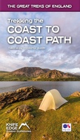 Wandelgids Trekking the Coast to Coast Path | Knife Edge Outdoor
The definitive two-way guide to the Coast to Coast Path: both eastbound and westbound routes are described in full. Real Maps: Full Ordnance Survey mapping inside (1:25,000). All accommodation is …
★★★★★
Laatste reviews

Heb de gids cadeau gedaan en die persoon was er heel blij mee ..
★★★★★ door J 21 november 2024 | Heeft dit artikel gekocht
De kaart van Kirgystan is prachtig, zeer gedetailleerd. Kan niet wachten tot de we echt op reis hmgaan die kant op.
★★★★★ door Marijke Eering 21 november 2024 | Heeft dit artikel gekocht
Super handig fiets boekje en mooi water bestendig. En handig om op de kaarten te kijken heel duidelijk beschrijving. Wij fietsen al jaren in Duitsland …
★★★★★ door Jenneke holterman 19 november 2024 | Heeft dit artikel gekocht
prima kaart levering en betaling allemaal vlot verlopen
★★★★★ door Marc Buts 19 november 2024 | Heeft dit artikel gekocht


