■ York
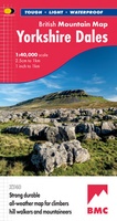 Wandelkaart Yorkshire Dales | Harvey Maps
A huge area on one map. Yorkshire Dales - the latest addition to the British Mountain Map series - is the sixth title in this highly successful & innovative range. …
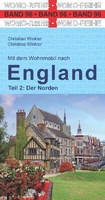 Campergids 96 nach England, der Norden | WOMO verlag
Tourenkarten Auf rund 4400 km in 11 Touren zu allen großen Attraktionen und weniger bekannten Orten in Nordengland reisen. Genaue Markierung freier Stell-, Bade-, Picknick-, Wander-, Pub- und Campingplätze incl. …
 Wegenkaart - landkaart Nord- und Mittelengland / Northern England & the Midlands | Reise Know-How Verlag
Hochreißfeste und 100% wasserfeste Landkarte "Nord- und Mittelengland" aus der Serie world mapping project, erschienen im Reise Know-How Verlag. Reise Know-How Landkarten zeichnen sich durch besonders stabiles Kunststoffpapier aus, …
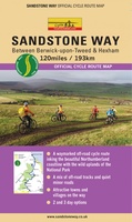 Fietskaart Sandstone Way - Northumberland Cycle Route Map | Northern Heritage Services
The Sandstone Way is a 120-mile mountain biking route between Berwick upon Tweed and Hexham that runs along the sandstone ridge in North Northumberland, linking numerous sandstone crags and outcrops. …
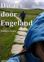 Reisverhaal Dwars door Engeland | Martijn van Rijsbergen
We willen een reis maken. Mijn Vriendin en ik. Op avontuur. We kunnen de hele wereld kiezen, het wordt Groot-Brittannië. Een verslag van een reis over één van de oudste, …
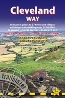 Wandelgids Cleveland Way | Trailblazer Guides
All the information you need to enjoy your hiking adventure along the Cleveland Way in this fully revised and updated 2nd edition. In the beautiful, wild countryside of the North …
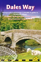 Wandelgids Dales Way | Trailblazer Guides
The popular Dales Way long-distance footpath begins in Ilkley, West Yorkshire and runs for 84 miles (135km) to end in the Lake District, in Bowness-on-Windermere. It follows riverside paths along …
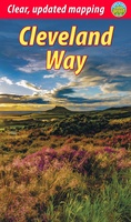 Wandelgids Cleveland Way | Rucksack Readers
“A testament to excellent research, writing and photography” - Malcolm Hodgson, Trail Manager The Cleveland Way is one of England’s oldest and best-loved National Trails. It runs for 108 …
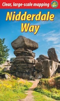 Wandelgids Nidderdale Way | Rucksack Readers
The Yorkshire Dales are famously beautiful valleys in northern England, but Nidderdale is perhaps the least known of them. Unique among the dales, this scenic valley has three large reservoirs …
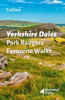 Wandelgids Park Rangers Favourite Walks Yorkshire Dales | Collins
Compacte wandelgids met 20 wandelingen geselecteerd door park rangers en met duidelijke beschrijvingen en routekaartjes. Walking guide to the Yorkshire Dales National Park, with 20 best routes chosen by …
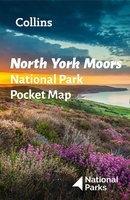 Wegenkaart - landkaart National Park Pocket Map North York Moors | Collins
Handige kleine kaart van dit Nationaal Park. De kaart geeft een goed en helder overzicht van het gebied met alle plaatsen, doorgaande wandelpaden (alhoewel grof van schaal), bezienswaardigheden etc. Met …
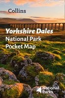 Wegenkaart - landkaart National Park Pocket Map Yorkshire Dales | Collins
Handige kleine kaart van dit Nationaal Park. De kaart geeft een goed en helder overzicht van het gebied met alle plaatsen, doorgaande wandelpaden (alhoewel grof van schaal), bezienswaardigheden etc. Met …
★★★★★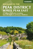 Wandelgids Walking in the Peak District - White Peak East | Cicerone
Uitstekende wandelgids van het Peak District van de gerenommeerde uitgever Cicerone. This guidebook provides 35 day walks and 7 longer walks and trails exploring the eastern section of Derbyshire's …
★★★★★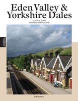 Reisgids PassePartout Eden Valley en Yorkshire Dales | Edicola
Dertig jaar geleden was de noordwestelijke Settle-Carlisle Railway nog ten dode opgeschreven. Tegenwoordig vervoert Engelands mooiste spoorlijn ieder jaar duizenden mensen door twee streken: de nog onontdekte Eden Valley met …
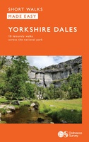 Wandelgids Yorkshire Dales | Ordnance Survey
Enjoy the magnificent waterfalls, sweeping scenery and cosy Dale pubs with ten short, leisurely walks suitable for all ages and abilities. Discover the Yorkshire Dales with its natural wonders, lush …
 Wandelgids 15 Short Walks Short Walks in Nidderdale | Cicerone
Jon Fallis has chosen 15 of the best short walks around Nidderdale in the Yorkshire Dales for you to explore. Our guide comes with easy-to-read Ordnance Survey maps and clear …
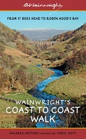 Wandelgids Wainwright's Coast to Coast Walk | Frances Lincoln
This is the first fully revised and updated edition of A. Wainwright's pocket-sized guide to the Coast to Coast Walk which he devised in the early 1970s. Over the years, …
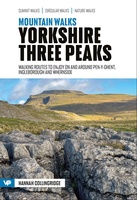 Wandelgids Mountain Walks Yorkshire Three Peaks: | Vertebrate Publishing
Mountain Walks Yorkshire Three Peaks by Hannah Collingridge is a guide to walking routes on and around Pen-y-ghent, Ingleborough and Whernside in the Yorkshire Dales National Park. Alongside the routes …
 Reisgids 111 places in Places in Leeds That You Shouldn't Miss | Emons
Welcome to Leeds; a great northern powerhouse of a city which has reinvented itself from an industrial centre of wool, textiles and coal to one of the country’s biggest financial …
 Reisgids 111 places in Places in Yorkshire That You Shouldn't Miss | Emons
They call Yorkshire God’s own country. This is because England’s biggest county is also England’s most epic and most historically exciting. It has everything: unimaginably beautiful countryside, derelict castles, cliff-hugging …
Laatste reviews

Heb de gids cadeau gedaan en die persoon was er heel blij mee ..
★★★★★ door J 21 november 2024 | Heeft dit artikel gekocht
De kaart van Kirgystan is prachtig, zeer gedetailleerd. Kan niet wachten tot de we echt op reis hmgaan die kant op.
★★★★★ door Marijke Eering 21 november 2024 | Heeft dit artikel gekocht
Super handig fiets boekje en mooi water bestendig. En handig om op de kaarten te kijken heel duidelijk beschrijving. Wij fietsen al jaren in Duitsland …
★★★★★ door Jenneke holterman 19 november 2024 | Heeft dit artikel gekocht
prima kaart levering en betaling allemaal vlot verlopen
★★★★★ door Marc Buts 19 november 2024 | Heeft dit artikel gekocht


