■ York
 Fietskaart Yorkshire Dales Touring / Nidderdale Area of NB | Harvey Maps
This map provides a colourful overview of the Dales - famous Swaledale, Wensleydale, Wharfedale & Nidderdale. Colour shading makes it easy to pick out the hills & dales. Driveable roads …
 Fietskaart Yorkshire Dales for Cyclists | Harvey Maps
The area covered by this new 100% waterproof map provides fabulous opportunities from gentle routes in the valleys to some challenging climbs over the moorland that separates them. It is …
 Wandelkaart Yorkshire Wolds Way | Harvey Maps
The Yorkshire Wolds Way is a 79 mile (127 km) walking route in the chalk landscape of the Yorkshire Wolds. The National Trail wends through some of the most tranquil …
 Wandelkaart Yorkshire Dales Noord-Oost | Harvey Maps
The Yorkshire Dales National Park on just 4 sheets. Yorkshire Dales North East: The coverage of this map includes Swaledale, Wharfedale, Wensleydale and Nidderdale. Genuine original HARVEY mapping at 1:25,000. …
 Wandelkaart Yorkshire Dales Zuid-Oost | Harvey Maps
The Yorkshire Dales National Park on just 4 sheets. Yorkshire Dales South East: The coverage of this map includes Pen-y-Ghent, Malham Cove, Wharfedale and Nidderdale. Genuine original HARVEY mapping at …
 Wandelkaart Yorkshire Dales Noord-West | Harvey Maps
The Yorkshire Dales National Park on just 4 sheets. Yorkshire Dales North West: The coverage of this map includes The Howgill Fells, upper Wensleydale and upper Swaledale. Genuine original HARVEY …
 Wandelkaart Yorkshire Dales Zuid-West | Harvey Maps
The Yorkshire Dales National Park on just 4 sheets. Yorkshire Dales South West: The coverage of this map includes Yorkshire Three Peaks, Whernside, Ingleborough and Pen-y-Ghent. Genuine original HARVEY mapping …
 Wandelkaart Yorkshire Dales Noord Oost | Harvey Maps
Covers a large area yet is handily compact. Pocket perfect! Detailed map for runners and walkers of the north eastern part of the Yorkshire Dales National Park at the …
 Wandelkaart Yorkshire Dales Noord West | Harvey Maps
Covers a large area yet is handily compact. Pocket perfect! Detailed map for runners and walkers of the north western part of the Yorkshire Dales National Park at the …
 Wandelkaart Yorkshire Dales Zuid Oost | Harvey Maps
HARVEY launch innovative new series: Ultramap XT40. 16 titles featuring in Trail magazine through spring 2016. 40 years experience have gone into HARVEY's most creative new series. The Ultramap covers …
 Wandelkaart Yorkshire Dales Zuid West | Harvey Maps
HARVEY launch innovative new series: Ultramap XT40. 16 titles featuring in Trail magazine through spring 2016. 40 years experience have gone into HARVEY's most creative new series. The Ultramap covers …
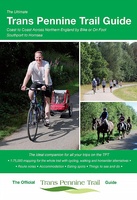 Fietsgids The Ultimate Trans Pennine Trail Guide | Excellent Books
Gidsboek voor de Trans Pennine Trail met spiraalbinding, inclusief kaarten, hoogtegrafieken en verblijfsmogelijkheden. The Trans Pennine Trail guide book covers the hugely popular 370 miles (595km) of trail across the …
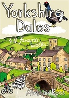 Wandelgids Yorkshire Dales | Pocket Mountains
Handige compacte wandelgids met 40 dagwandelingen. Deze gids bevat kleine kaartjes en leuke uitgebreide informatie over wat er langs de route te zien is. Goede wandelkaarten zijn echter we noodzakelijk …
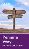 Wandelkaart National Trail Map Pennine Way | Collins
Overzichtskaart op vrij grove schaal van deze LAW Lange Afstands Wandeling in Engeland. Let op: je kunt er niet op lopen. Wel met veel informatie op de kaart, goed ingetekend, …
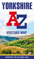 Wegenkaart - landkaart Visitors map Yorkshire | A-Z Map Company
Explore the whole region of Yorkshire extending from Sheffield to Darlington. With detailed road mapping and illustrated town plans of major cities, this feature rich, helpful tourist guide is ideal …
★★★★★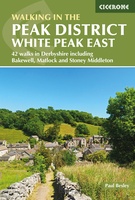 Wandelgids Walking in the Peak District - White Peak East | Cicerone
Uitstekende wandelgids van het Peak District van de gerenommeerde uitgever Cicerone. This guidebook provides 35 day walks and 7 longer walks and trails exploring the eastern section of Derbyshire's …
★★★★★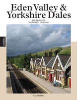 Reisgids PassePartout Eden Valley en Yorkshire Dales | Edicola
Dertig jaar geleden was de noordwestelijke Settle-Carlisle Railway nog ten dode opgeschreven. Tegenwoordig vervoert Engelands mooiste spoorlijn ieder jaar duizenden mensen door twee streken: de nog onontdekte Eden Valley met …
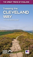 Wandelgids Trekking the Cleveland Way | Knife Edge Outdoor
The definitive two-way guide to the Cleveland Way, one of England's epic National Trails: both eastbound and westbound routes are described in full. Real Maps: Full Ordnance Survey mapping …
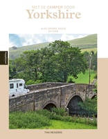 Campergids - Reisgids Met de camper door Yorkshire | Edicola
Yorkshire is een paradijs voor stoere wandelaars, natuurliefhebbers, honden, vogelaars, liefhebbers van ruïnes en van helemaal niet slaperige dorpjes en natuurlijk van Engelse pubs. Yorkshire heeft een spannende kust met …
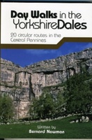 Wandelgids Day Walks in the Yorkshire Dales | Vertebrate Publishing
Day Walks in the Yorkshire Dales is the fourth title in Vertebrate Publishing's series of compact and portable hillwalking guidebooks. This book showcases 20 circular walks in the Yorkshire Dales …
Laatste reviews

Ik heb deze kaart gebruikt bij het wandelen van Zuid naar Noord Lanzarote. De kaart blijft zelfs goed bij vouwen en buigen.
★★★★★ door saar 25 november 2024 | Heeft dit artikel gekocht
Goede kaart, waterbestendig
★★★★★ door Bas 25 november 2024 | Heeft dit artikel gekocht
Was een hele goede keuze geweest. Enorm tevreden.
★★★★★ door Annet kriesels-Potters 25 november 2024 | Heeft dit artikel gekocht
zie boven
★★★★★ door Sabine Cohen 25 november 2024 | Heeft dit artikel gekocht


